Bharatpur District is located in eastern Rajasthan and is popularly known as the Eastern Gateway of Rajasthan. The district is part of the historic Braj cultural region and is famous for its royal Jat history, Lohagarh Fort, Keoladeo National Park, temples, wetlands and agricultural economy.
Bharatpur city is the district headquarters as well as the headquarters of Bharatpur Division. The district has strong road and railway connectivity with Delhi, Agra, Mathura and other cities of northern India. After the creation of Deeg District in 2023, the present Bharatpur district has a smaller administrative area than the older district.
Quick Information About Bharatpur District
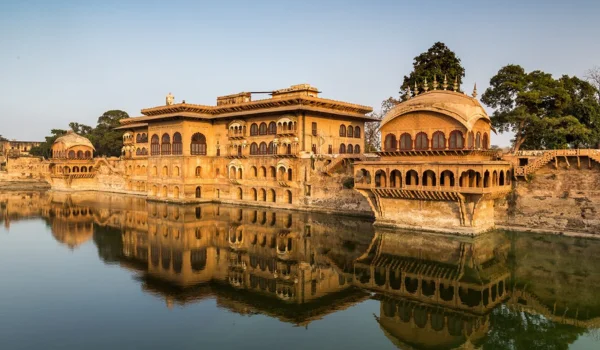
| Particular | Details |
| District | Bharatpur |
| State | Rajasthan |
| District Headquarters | Bharatpur |
| Formation | 1825 as a princely state; district administration evolved later |
| Present Area | About 2,897 sq. km. after separation of Deeg |
| Population | 14,75,707 based on 2011 Census boundaries adjusted after Deeg separation |
| Literacy Rate | About 71% based on Census-era figures |
| Administrative Region | Bharatpur Division |
| Main Languages | Hindi and Braj |
| Major Rivers | Gambhir, Banganga and Ruparel |
| Famous For | Keoladeo National Park, Lohagarh Fort, Bharatpur Palace and Jat heritage |
| Important Towns | Bharatpur, Bayana, Nadbai, Weir, Bhusawar, Rupbas, Uchchain |
The current district has eight tehsils/sub-districts: Bayana, Bharatpur, Bhusawar, Nadbai, Rudawal, Rupbas, Uchchain and Weir. Some older sources show Deeg, Kaman, Kumher and other areas as part of Bharatpur because they refer to the pre-2023 district boundaries.
Important PIN Codes in Bharatpur District
PIN codes are important for postal communication, online deliveries, banking, government correspondence and local identification. Some important PIN codes in the district include:
| Area / Town | PIN Code |
| Bharatpur | 321001 |
| Bayana | 321401 |
| Nadbai | 321602 |
| Weir | 321408 |
| Bhusawar | 321406 |
| Rupbas | 321204 |
| Uchchain | 321302 |
| Rudawal | 321402 |
| Sewar | 321303 |
| Band Baretha | 321409 |
PIN codes can vary between individual villages and post offices. The exact post office should be checked before using a PIN for official or postal purposes.
Important Facts About Bharatpur District
Here are some useful facts that make Bharatpur distinctive:
- Bharatpur is located in eastern Rajasthan.
- Bharatpur city is the district headquarters.
- The district is part of the historic Braj region.
- Bharatpur is popularly known as the Eastern Gateway of Rajasthan.
- The district is famous for Keoladeo National Park, a UNESCO World Heritage Site.
- Lohagarh Fort is one of the most important historical monuments in Bharatpur.
- The Bharatpur kingdom was established by the Jat rulers, particularly Maharaja Suraj Mal.
- The district has important Hindu religious sites including Ganga Mandir and Laxman Mandir.
- Agriculture is an important part of the local economy.
- Major crops include wheat, mustard, bajra, rice and other seasonal crops.
- Bayana is an important historic town known for its forts and medieval heritage.
- Band Baretha is known for its dam, wildlife and birdwatching opportunities.
- The district has strong connections with Agra, Mathura and Delhi-NCR.
- Braj culture, festivals and traditions influence local life.
- Bharatpur is an important destination for birdwatching and heritage tourism.
Location and Geography
Bharatpur is situated in the eastern part of Rajasthan near the borders of Uttar Pradesh and Haryana. Its geographical position has historically made it an important connection between Rajasthan, the Braj region and the Gangetic plains.
The district shares boundaries with:
- Deeg District towards the north
- Uttar Pradesh towards the east
- Dholpur District towards the south
- Karauli and Dausa districts towards the west and south-west
- Alwar District towards the north-west
Important geographical features include:
- Flat and fertile agricultural plains
- Gambhir River
- Banganga River
- Ruparel River
- Wetlands around Keoladeo
- Band Baretha reservoir
- Low hills around Bayana and nearby areas
- Seasonal drainage channels
The district’s relatively flat terrain and availability of water have supported agriculture, settlement and the development of wetlands.
History of Bharatpur District
Bharatpur has a rich history extending from ancient traditions to the powerful Jat kingdom of the eighteenth century.
Ancient History
The wider Bharatpur region has historical associations with the ancient Matsya cultural area. Rajasthan Tourism also connects the area’s early history with the Matsya kingdom and traditions related to the Mahabharata period.
The region later came under the influence of various kingdoms and political powers of northern India.
Rise of the Jat Kingdom
The modern historical identity of Bharatpur is strongly associated with the Jat rulers.
In the eighteenth century, Maharaja Suraj Mal emerged as the most important ruler of the Bharatpur kingdom. He strengthened the kingdom, expanded its territories and developed important forts and palaces.
Lohagarh Fort became the major defensive centre of the kingdom.
Lohagarh and British Conflicts
Lohagarh Fort developed a reputation for its strong defensive design. Its massive walls, surrounding moat and strategic construction made it difficult for attacking forces to capture.
The fort successfully resisted several British attacks, becoming an important symbol of the military strength of the Bharatpur rulers.
Bharatpur Princely State
Bharatpur continued as a princely state during the British period. Its rulers developed palaces, temples, gardens, water systems and administrative institutions.
The kingdom’s heritage can still be seen in the fort, palace, temples and historic neighbourhoods of Bharatpur.
Modern Bharatpur
After Indian independence, Bharatpur became part of Rajasthan. It later developed as a district and administrative centre.
The establishment and development of Keoladeo National Park gave Bharatpur international recognition as one of the world’s important bird habitats.
Population of Bharatpur District
The 2011 Census recorded 25,48,462 people in the undivided Bharatpur district.
Following the creation of Deeg district in 2023, the population attributable to the present Bharatpur district is approximately 14.76 lakh based on adjusted 2011 Census boundaries.
The present district has a significant rural population, although Bharatpur city is an important urban centre. Other important towns include Bayana, Nadbai, Weir, Bhusawar, Rupbas and Uchchain.
Hindi is widely spoken, while Braj has strong cultural and linguistic importance because of the district’s location within the Braj region.
Economy of Bharatpur District
The economy of Bharatpur combines agriculture, tourism, trade, transport, services and small industries.
Major economic sectors include:
- Agriculture
- Dairy and livestock
- Food processing
- Oilseed processing
- Handicrafts
- Small-scale manufacturing
- Tourism
- Hospitality
- Retail trade
- Transport and logistics
Tourism is particularly important because the district attracts visitors to Keoladeo National Park, Lohagarh Fort and other heritage attractions.
Agriculture in Bharatpur
Agriculture is an important source of employment in rural Bharatpur.
The fertile plains and irrigation facilities support several crops.
Major agricultural crops include:
- Wheat
- Mustard
- Bajra
- Rice
- Barley
- Pulses
- Vegetables
- Seasonal fodder crops
Mustard is an important oilseed crop in the region. Dairy farming and livestock rearing also supplement agricultural incomes.
Water from local rivers, reservoirs, canals and groundwater sources supports farming, although agricultural production remains dependent on seasonal rainfall and irrigation availability.
Handloom and Traditional Industries
Bharatpur’s traditional economy includes handicrafts, local textile activities and small household industries.
Local Handicrafts
Traditional craft products are sold through local markets and tourism-related outlets. Visitors can find products associated with the broader craft traditions of eastern Rajasthan and the Braj region.
Stone and Construction-Related Work
The wider Bayana and eastern Rajasthan region has a history of stone-related work and construction materials. Local businesses connected with building materials and small manufacturing also contribute to the economy.
Food and Rural Products
Dairy products, agricultural produce, traditional sweets and locally processed food products are important parts of the district’s rural economy.
Industries and Business in Bharatpur District
Bharatpur has a developing industrial and commercial economy, although agriculture and services remain major contributors.
Important business sectors include:
- Food processing
- Dairy processing
- Oilseed processing
- Agricultural trading
- Construction materials
- Small manufacturing
- Tourism and hospitality
- Transport
- Retail markets
- Education and healthcare services
Bharatpur city functions as the principal commercial centre. Bayana, Nadbai, Weir and Bhusawar also serve surrounding rural markets.
The district’s location close to Agra, Mathura and Delhi-NCR provides opportunities for trade, logistics and tourism-related businesses.
Education in Bharatpur
Bharatpur has schools, colleges, technical institutions and other educational facilities serving the district and surrounding rural areas.
Bharatpur city is the main education centre. Students from Bayana, Nadbai, Weir and other towns often travel to the city for higher education and professional courses.
The district’s educational network includes government and private schools, degree colleges, professional institutions and vocational training facilities.
District Court in Bharatpur
The District Court of Bharatpur provides judicial services for the district. It handles civil, criminal and other matters under the jurisdiction of the district judiciary.
The judicial system is supported by subordinate courts and other legal institutions. Revenue courts and administrative authorities separately deal with land and revenue-related matters.
District Hospital and Healthcare
Bharatpur has government and private healthcare facilities serving the urban and rural population.
Important healthcare infrastructure includes:
- District-level government hospital services
- Medical and specialist healthcare
- Community Health Centres
- Primary Health Centres
- Sub-centres
- Maternal and child healthcare
- Immunisation services
- Emergency healthcare
- Private hospitals and clinics
Bharatpur city is the main healthcare centre for residents from different parts of the district.
Popular Tourist Attractions in Bharatpur District
Bharatpur is one of Rajasthan’s most interesting destinations for wildlife, birdwatching, royal history and religious tourism.
- Keoladeo National Park
Keoladeo National Park, formerly known as Bharatpur Bird Sanctuary, is the district’s most internationally recognised attraction.
It is a UNESCO World Heritage Site and one of the world’s important wetland habitats for birds. More than 370 bird species have been recorded here, including migratory waterbirds, raptors, waders and many resident species.
Visitors can explore the park on foot, by bicycle or through authorised cycle-rickshaw services.
- Lohagarh Fort
Lohagarh Fort is the most important historical monument in Bharatpur city.
Built under the Jat rulers, the fort is known for its strong defensive walls and moat. Important structures within the complex include Kothi Khas, Mahal Khas, Moti Mahal, Kishori Mahal, Jawahar Burj and Fateh Burj.
- Bharatpur Palace and Museum
The Bharatpur Palace and Museum is located near the fort and represents a mixture of Rajput and Mughal architectural influences.
The museum houses historical sculptures, manuscripts, decorative objects and other artefacts connected with the heritage of Bharatpur.
- Ganga Mandir
Ganga Mandir is one of the prominent temples in Bharatpur city.
The temple is dedicated to Goddess Ganga and is known for its white marble deity and detailed architecture. It is an important religious landmark in the city.
- Laxman Mandir
Laxman Mandir is a historic temple dedicated to Lord Laxman.
The temple is recognised for its detailed stone carving, decorative pillars and traditional architectural style. It is situated in the heart of Bharatpur city.
- Band Baretha
Band Baretha is an old wildlife and water-reserve area associated with the former Bharatpur rulers.
The dam was developed on the Kakund River and the area is known for its reservoir, greenery and birdlife. More than 200 bird species have been recorded in the wider area.
- Bayana Fort
Bayana is an important historic town in the southern part of the district.
The area has forts, old monuments and archaeological remains connected with medieval north Indian history. Bayana’s strategic location made it important during several periods of political conflict.
- Jawahar Burj and Fateh Burj
Jawahar Burj and Fateh Burj are important structures within the Lohagarh Fort complex.
They commemorate military victories associated with the Bharatpur rulers and form an important part of the district’s Jat-era heritage.
- Rudawal and Surrounding Heritage
Rudawal and nearby areas contain old temples and rural heritage locations.
The region is useful for travellers interested in exploring less-commercial destinations and the cultural landscape around Bharatpur.
- Keoladeo Birdwatching Areas
Beyond the main park routes, the wetland landscape around Keoladeo offers excellent opportunities for birdwatching and nature photography.
The winter season is particularly attractive because many migratory birds arrive in the region.
Transport and Connectivity
Road Connectivity
Bharatpur has strong road connectivity with Agra, Mathura, Jaipur, Dholpur, Alwar, Delhi-NCR and other parts of Rajasthan and Uttar Pradesh.
Its location close to major cities makes it convenient for both tourism and commercial transport.
Railway Connectivity
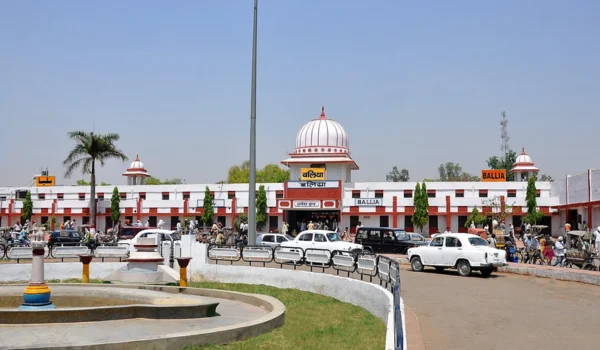
Bharatpur Junction is an important railway station on the Delhi-Mumbai railway route.
The district has rail connections towards Delhi, Agra, Mathura, Jaipur, Mumbai and other major cities, making Bharatpur particularly convenient for tourists.
Air Connectivity
Bharatpur does not have a major scheduled commercial airport of its own.
Agra Airport is a nearby regional option, while Jaipur International Airport and Indira Gandhi International Airport in Delhi provide broader domestic and international connectivity. Travellers should check current flight schedules before planning an air journey.
Best Time to Visit Bharatpur District
The best time to visit Bharatpur is generally October to March, especially for wildlife, birdwatching and outdoor sightseeing.
The winter months are particularly suitable for visiting Keoladeo National Park, when migratory birds can be seen.
Popular activities include:
- Birdwatching at Keoladeo
- Exploring Lohagarh Fort
- Visiting Bharatpur Palace and Museum
- Visiting Ganga Mandir
- Exploring Laxman Mandir
- Visiting Band Baretha
- Exploring Bayana’s heritage
Summer can be very hot, so outdoor sightseeing is generally more comfortable during the cooler months.
Nearby Cities, Districts and Areas
Important nearby cities and districts include:
- Agra, Uttar Pradesh
- Mathura, Uttar Pradesh
- Deeg
- Dholpur
- Alwar
- Dausa
- Karauli
- Jaipur
- Delhi-NCR
Bharatpur’s location between Rajasthan, Uttar Pradesh and the Braj region gives it strong cultural, economic and tourism connections with northern India.
Why Is Bharatpur District Important?
Bharatpur is important because it combines wildlife conservation, royal history, Jat heritage, agriculture and Braj culture.
Its major strengths include:
- Keoladeo National Park
- UNESCO World Heritage status
- Lohagarh Fort
- Bharatpur Palace and Museum
- Jat history and Maharaja Suraj Mal
- Ganga Mandir and Laxman Mandir
- Band Baretha
- Bayana’s historical heritage
- Agricultural economy
- Excellent regional connectivity
The district is particularly important for Rajasthan’s wildlife tourism because Keoladeo attracts birdwatchers, nature lovers, researchers and tourists from India and abroad.
FAQs About Bharatpur District
What is Bharatpur district famous for?
Bharatpur is famous for Keoladeo National Park, Lohagarh Fort, Bharatpur Palace, birdwatching and its Jat royal heritage.
What is the headquarters of Bharatpur district?
The district headquarters is Bharatpur city.
Is Deeg part of Bharatpur district?
No. Deeg became a separate district in 2023. Older sources may still describe Deeg and other areas as part of the former larger Bharatpur district.
What is Keoladeo National Park famous for?
Keoladeo is famous for its rich birdlife and wetland ecosystem. It is a UNESCO World Heritage Site and records more than 370 bird species.
Who was Maharaja Suraj Mal?
Maharaja Suraj Mal was one of the most important rulers of the Bharatpur Jat kingdom. He played a major role in strengthening Bharatpur and developing its forts and palaces.
Which rivers are important in Bharatpur?
The Gambhir, Banganga and Ruparel are important rivers associated with the district.
What is the best time to visit Bharatpur?
October to March is generally the best period, particularly for birdwatching at Keoladeo National Park and comfortable heritage sightseeing.
Conclusion
Bharatpur District is one of eastern Rajasthan’s most important destinations for wildlife, history, religion and culture. Its identity is strongly associated with Keoladeo National Park, Lohagarh Fort, Maharaja Suraj Mal, Bharatpur Palace and the traditions of the Braj region.
The district also has an important agricultural and commercial economy supported by Bharatpur city, Bayana, Nadbai, Weir and other towns. Its railway and road connections with Delhi, Agra, Mathura and Jaipur further strengthen its importance as a tourism and regional economic centre.