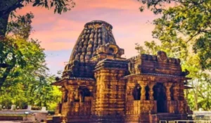
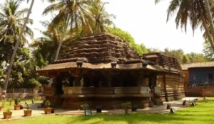
Bijnor District is located in the northwestern part of Uttar Pradesh and forms part of the Moradabad administrative division. The district headquarters is Bijnor city. It occupies an important position between the Ganga plains and the foothills of the Himalayas.
Bijnor is known for its rich history, religious heritage, agricultural economy, sugarcane cultivation, forests and cultural diversity. Places such as Vidur Kuti, Najibabad, Daranagar and ancient temples give the district considerable historical and religious importance.
Quick Information About Bijnor District
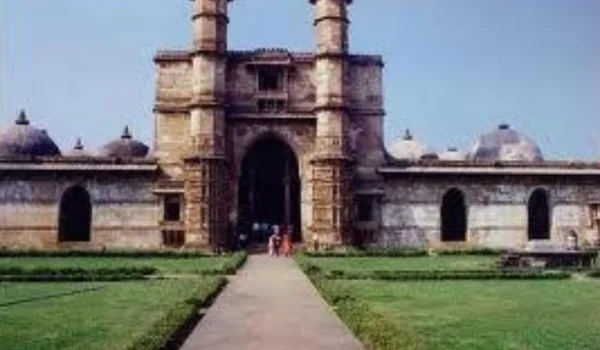
| Particular | Details |
| District | Bijnor |
| State | Uttar Pradesh |
| District Headquarters | Bijnor |
| Area | 4,561 sq. km |
| Population | 36,82,713 (2011 Census) |
| Literacy Rate | 68.48% |
| Sex Ratio | 917 females per 1,000 males |
| Revenue Sub-Divisions | 5 |
| Tehsils | 5 |
| Development Blocks | 11 |
| Villages | 2,519 |
| Nagar Palika Parishad/Nagar Panchayats | 18 |
| Main Language | Hindi |
| Major Rivers | Ganga, Ramganga and Khoh |
| Famous For | Sugarcane, agriculture, historical sites, religious heritage and forests |
| Important Towns | Bijnor, Najibabad, Dhampur, Nagina, Chandpur, Seohara, Nehtaur and Kiratpur |
According to district administration information, Bijnor has 5 revenue sub-divisions, 5 tehsils, 11 development blocks and 2,519 villages. The 2011 Census recorded a population of 36,82,713.
Important PIN Codes in Bijnor District
PIN codes are important for postal communication, government documents, deliveries and identifying local post offices.
| Area/Town | PIN Code |
| Bijnor | 246701 |
| Najibabad | 246763 |
| Dhampur | 246761 |
| Nagina | 246762 |
| Chandpur | 246725 |
| Seohara | 246746 |
| Nehtaur | 246733 |
| Kiratpur | 246731 |
| Noorpur | 246734 |
| Bijnor City areas | 246701 |
| Mandawar | 246721 |
| Haldaur | 246726 |
PIN codes can differ between individual villages and post offices, so the exact locality should be confirmed before sending important documents or parcels.
Important Facts About Bijnor District
Here are some useful facts that make Bijnor distinctive:
- Bijnor city is the district headquarters.
- The district covers approximately 4,561 sq. km.
- Bijnor had a population of 36,82,713 according to the 2011 Census.
- The district is part of the Moradabad Division.
- Bijnor lies close to the Himalayan foothill region.
- The Ganga River forms an important geographical feature.
- Agriculture and sugarcane cultivation are major economic activities.
- Sugar mills and agro-based businesses are important to the district economy.
- Najibabad is an important historical town.
- Najib-ud-Daulah’s Fort is an important heritage site.
- Vidur Kuti is associated with the Mahabharata tradition.
- The district has a strong mix of Hindu, Muslim, Sikh, Jain and other cultural traditions.
- Nagina is historically associated with traditional craft and trade.
- Mangoes and sugarcane are important agricultural products.
- The district has road and railway connections with major cities of western and northern Uttar Pradesh.
Location and Geography
Bijnor is situated in the northwestern part of Uttar Pradesh. The district occupies a transition zone between the fertile plains of the Ganga basin and the Himalayan foothills.
The district shares boundaries with:
- Uttarakhand in the north
- Muzaffarnagar toward the west
- Meerut toward the southwest
- Amroha toward the west and northwest
- Moradabad toward the east
- Sambhal toward the southwest
- Ganga River along parts of the western and southern side
Important geographical features include:
- Ganga River
- Ramganga River
- Khoh River
- Ganga floodplains
- Terai-influenced northern areas
- Agricultural plains
- Forested areas
- Himalayan foothill landscapes
The district’s geographical position supports agriculture, forestry, river-based ecosystems and trade between the plains and the Himalayan region.
History of Bijnor District
Ancient History
Bijnor has a long historical and cultural tradition. Local traditions connect the region with King Dushyant, Shakuntala, Emperor Bharat, Sage Kanva and Mahatma Vidur.
Vidur Kuti, located near Bijnor, is particularly important in local religious tradition. It is believed to be associated with Mahatma Vidur, a prominent figure in the Mahabharata.
The region has also been associated with ancient settlements and religious centres that developed along the Ganga and other river systems.
Medieval Period
During the medieval period, Bijnor was influenced by several political powers, including the Delhi Sultanate, Mughal Empire and regional rulers.
The Mughal period had a major influence on the cultural development of the district. The region later came under the control of Rohilla chiefs and other local powers.
Najibabad and Najib-ud-Daulah
Najibabad became an important centre during the eighteenth century. Najib-ud-Daulah, also known as Najib Khan Rohilla, established the town and developed it as an important political centre.
The historic fort associated with Najib-ud-Daulah remains one of the significant heritage structures in the district.
British Period
Bijnor came under British control during the nineteenth century. The district became part of the administrative structure of British India and later the United Provinces.
The region also witnessed activity during the Revolt of 1857, when local resistance emerged against British authority.
Modern History
After Independence, Bijnor became part of Uttar Pradesh. The district developed as an agricultural and commercial region, with sugarcane, sugar mills, trade, education and transport becoming important parts of the modern economy.
Its location near Uttarakhand and major northern Indian markets has also contributed to its regional importance.
Population of Bijnor District
According to the 2011 Census, Bijnor District had a population of 36,82,713, including 19,21,215 males and 17,61,498 females. The district recorded a sex ratio of 917 females per 1,000 males.
The 2011 literacy rate was approximately 68.48%, with male literacy higher than female literacy. The district has both rural and urban populations, with a large number of people depending on agriculture and related activities.
Bijnor has a culturally diverse population. Hindi is the principal language used for administration and everyday communication, while local speech reflects the cultural influence of the wider Rohilkhand and western Uttar Pradesh region.
Economy of Bijnor District
The economy of Bijnor is strongly connected with agriculture, sugarcane, agro-processing, trade and small businesses.
Important economic activities include:
- Agriculture
- Sugar manufacturing
- Food processing
- Agricultural trading
- Dairy and livestock
- Small-scale manufacturing
- Handicrafts
- Retail trade
- Transport
- Forestry-related activities
- Education and healthcare services
The district’s fertile plains and irrigation facilities support extensive agricultural production.
Agriculture in Bijnor
Agriculture is one of the main sources of livelihood in Bijnor.
Major crops and agricultural products include:
- Sugarcane
- Wheat
- Paddy
- Maize
- Mustard
- Pulses
- Vegetables
- Mangoes
- Other seasonal fruits
Sugarcane is particularly important because it supports a large sugar-processing industry in the district.
The Ganga and other river systems, canals, tube wells and groundwater resources contribute to irrigation. Areas near the rivers also have fertile alluvial soils suitable for crop cultivation.
Handloom and Traditional Industries
Bijnor has a long tradition of small-scale and household-based crafts.
Traditional activities include:
- Textile work
- Woodwork
- Bamboo and cane products
- Handicrafts
- Embroidery
- Local decorative products
- Traditional food processing
Nagina is particularly well known for its traditional wood-carving craft, especially decorative ebony woodwork. This craft has contributed to the cultural and commercial identity of the district.
The district’s traditional arts have been influenced by both local traditions and the Mughal and Rohilla cultural heritage.
Industries and Business in Bijnor
Bijnor has a primarily agro-based and small-industry economy.
Sugar Industry
Sugar manufacturing is one of the most important industrial activities because of the large-scale cultivation of sugarcane.
Food and Agro-Processing
Rice, wheat, sugarcane and other agricultural products support food-processing and agricultural trading businesses.
Small-Scale Industries
Other business activities include:
- Wood products
- Furniture
- Handicrafts
- Packaging
- Retail
- Transport
- Construction
- Dairy
- Local manufacturing
Bijnor, Najibabad, Dhampur, Nagina, Chandpur and Seohara are important commercial centres.
Education in Bijnor
Bijnor has a network of government and private schools, colleges and higher-education institutions.
The district provides education in arts, science, commerce, professional subjects and technical fields. Colleges and educational institutions are concentrated in major towns, while schools serve rural communities across the district.
Education has an important role in the social and economic development of Bijnor, especially for rural communities.
District Court in Bijnor
The District Court, Bijnor provides judicial services for residents of the district. It deals with civil, criminal and other legal matters under the applicable judicial framework.
Judicial services are supported by courts and legal institutions serving different parts of the district.
For a specific legal matter, visitors should confirm the current court location, working hours and documentation requirements before travelling.
District Hospital and Healthcare
Bijnor has a government healthcare network serving both urban and rural populations.
Important healthcare facilities include:
- District-level hospital services
- Community Health Centres
- Primary Health Centres
- Sub-centres
- Maternal and child healthcare
- Immunisation services
- Emergency services
- Rural healthcare programmes
- Referral services
Private hospitals, clinics and diagnostic centres are also available in larger towns such as Bijnor, Najibabad and Dhampur.
Popular Tourist Attractions in Bijnor
Bijnor offers a mix of religious sites, historical monuments, river landscapes, traditional culture and natural attractions. The district administration identifies several historical forts, temples, ashrams and religious sites as places of interest.
- Vidur Kuti
Vidur Kuti is one of the most important religious and historical attractions near Bijnor. It is traditionally associated with Mahatma Vidur from the Mahabharata.
The site is surrounded by a peaceful rural and riverine environment and attracts visitors interested in mythology and religious heritage.
- Daranagar
Daranagar is associated with the traditions surrounding Vidur Kuti and the Mahabharata. According to local tradition, the area was connected with the protection of women and children during the Mahabharata period.
It is an interesting destination for visitors exploring the mythological heritage of Bijnor.
- Najib-ud-Daulah’s Fort
Located in Najibabad, this historic fort is associated with Najib-ud-Daulah, the eighteenth-century Rohilla leader.
The monument reflects the political history of the Rohilla period and is one of the better-known historical structures of Bijnor.
- Najibabad
Najibabad is one of the district’s important historical towns. It was established by Najib-ud-Daulah and developed into an important centre during the eighteenth century.
Its old structures, religious sites and historical associations make it a useful destination for heritage tourism.
- Sita Mandir Math
The Sita Mandir Math near Nanore is traditionally associated with Sita from the Ramayana. It is an important religious site and attracts devotees from surrounding areas.
- Dargah-e-Aaliya Najaf-e-Hind, Jogipura
This religious site in the Najibabad area is associated with the Sufi and Islamic heritage of the district.
Its history is linked with the Mughal period and the religious traditions that developed in the region.
- Sikaida
Sikaida, located on the Nagina-Bijnor road, is listed among the district’s tourist attractions. Its natural surroundings and local importance make it a destination for visitors exploring the less-commercialised areas of Bijnor.
- Shakarpuri
Shakarpuri village, located along the Najibabad-Bijnor road, is known locally for its mangoes and sugarcane.
The area provides an example of the agricultural character of the district.
- Ganga River Areas
The Ganga forms an important part of Bijnor’s landscape. Riverbank areas provide opportunities for religious activities, nature visits and understanding the agricultural geography of the district.
The surrounding riverine landscape is especially attractive during the cooler months.
- Bijnor Religious Heritage
Bijnor city contains temples, mosques, shrines, churches and other religious structures representing different traditions.
The district administration describes Bijnor as a centre of religious diversity, with sites associated with Hinduism, Islam, Christianity, Buddhism, Jainism and Sikhism.
Transport and Connectivity
Road Connectivity
Bijnor has road connectivity with major towns and cities of western Uttar Pradesh and neighbouring Uttarakhand.
Important road routes connect the district with:
- Meerut
- Moradabad
- Haridwar
- Muzaffarnagar
- Amroha
- Najibabad
- Dhampur
- Chandpur
Roads also connect rural areas with the district headquarters and major market towns.
Railway Connectivity
Bijnor has railway connectivity through stations including Bijnor, Najibabad, Dhampur, Nagina and Chandpur.
Najibabad Junction is an important railway point for the wider region and provides connections toward northern India.
Air Connectivity
Bijnor does not have a major commercial airport. Travellers generally use nearby airports such as Dehradun’s Jolly Grant Airport or Delhi’s Indira Gandhi International Airport, depending on the travel route, and continue by road or rail.
Best Time to Visit Bijnor
The most comfortable period for sightseeing is generally October to March. The weather during these months is more suitable for visiting historical sites, temples, river areas and nearby natural attractions.
Visitors can consider:
- Exploring Vidur Kuti
- Visiting Najibabad’s historical sites
- Exploring religious heritage
- Visiting Ganga river areas
- Exploring local markets
- Experiencing traditional fairs and festivals
- Exploring rural and agricultural landscapes
The monsoon season can make some riverine and rural areas difficult to access, while summer temperatures can be high.
Nearby Cities, Districts and Areas
Important nearby cities, districts and regions include:
- Moradabad
- Amroha
- Muzaffarnagar
- Meerut
- Haridwar
- Roorkee
- Kotdwar
- Uttarakhand
- Saharanpur
- Nagina
- Najibabad
- Dhampur
Bijnor’s location between western Uttar Pradesh and the Himalayan foothills gives it importance for agriculture, trade, transportation and cultural interaction.
Why Is Bijnor District Important?
Bijnor is important because of its historical heritage, agricultural economy, religious diversity, sugar industry and location near the Himalayan foothills.
Its major strengths include:
- Rich ancient and mythological heritage
- Vidur Kuti
- Najibabad’s Rohilla history
- Ganga river landscape
- Sugarcane cultivation
- Sugar industry
- Traditional wood carving
- Agricultural economy
- Religious diversity
- Connectivity with Uttar Pradesh and Uttarakhand
The district combines a strong rural agricultural economy with historical towns and culturally important religious sites.
FAQs About Bijnor District
What is Bijnor District famous for?
Bijnor is famous for sugarcane cultivation, sugar industries, historical sites, Vidur Kuti, Najibabad’s heritage, traditional crafts and religious diversity.
What is the headquarters of Bijnor District?
The headquarters of Bijnor District is Bijnor city.
What is the population of Bijnor District?
According to the 2011 Census, Bijnor District had a population of 36,82,713.
What is the area of Bijnor District?
Bijnor District covers approximately 4,561 sq. km according to the district’s demographic data.
Which rivers are important in Bijnor?
The Ganga, Ramganga and Khoh are important rivers associated with the district.
Which are the major tourist places in Bijnor?
Major attractions include Vidur Kuti, Daranagar, Najib-ud-Daulah’s Fort, Najibabad, Sita Mandir Math, Dargah-e-Aaliya Najaf-e-Hind, Sikaida and Ganga river areas.
What is Bijnor’s main crop?
Sugarcane is one of the most important crops of Bijnor and supports the district’s significant sugar industry.
Conclusion
Bijnor District is a historically and culturally important region of Uttar Pradesh. Its location near the Ganga plains and Himalayan foothills has shaped its agriculture, settlement, economy and history. The district’s connection with Vidur Kuti, Najibabad, Rohilla heritage and diverse religious traditions gives it a distinctive identity.
Agriculture, sugarcane cultivation, sugar manufacturing, traditional crafts, trade and services form the foundation of the modern economy. With its historical monuments, religious sites, river landscapes and cultural heritage, Bijnor remains an important district of northern Uttar Pradesh.