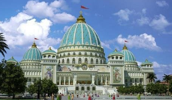
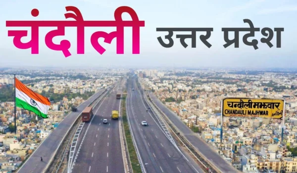
Chandauli is a district in eastern Uttar Pradesh, located close to the Bihar border and the major cultural city of Varanasi. The district is known for its waterfalls, forests, temples, rice cultivation and important railway connectivity.
Chandauli town is the district headquarters. The district has a mix of fertile agricultural plains, forested areas and the Vindhyan landscape. Important attractions include Devdari Waterfall, Latif Shah Tomb and Chandra Prabha Wildlife Sanctuary.
Agriculture, trade, transport, tourism and small-scale businesses are important parts of the local economy.
Quick Information About Chandauli District
| Particular | Details |
| District | Chandauli |
| State | Uttar Pradesh |
| District Headquarters | Chandauli |
| Division | Varanasi Division |
| Formation | 1997 |
| Area | About 2,554 sq. km |
| Population | 19,52,756 (Census 2011) |
| Main Language | Hindi |
| Major Rivers | Ganga and Karamnasa |
| Famous For | Chandra Prabha Wildlife Sanctuary, waterfalls and rice cultivation |
| Important Towns | Chandauli, Mughalsarai, Sakaldiha, Chakia and Saiyadraja |
| Major Economic Activities | Agriculture, rice production, trade, transport and tourism |
Important PIN Codes in Chandauli District
Different towns, villages and post offices in Chandauli district have separate PIN codes.
| Area / Town | PIN Code |
| Chandauli | 232104 |
| Chakia | 232103 |
| Mughalsarai | 232101 |
| Sakaldiha | 232109 |
| Saiyadraja | 232110 |
| Baburi | 232102 |
| Dhanapur | 232105 |
| Kamalpur | 232107 |
| Mughal Sarai Railway Station | 232101 |
| Naugarh | 232111 |
Chandauli town, the district headquarters, uses PIN code 232104. PIN codes can vary between nearby villages and individual post offices, so the exact locality should be checked before using one for postal or official purposes.
Important Facts About Chandauli District
Some useful facts about Chandauli include:
- Chandauli is located in eastern Uttar Pradesh.
- Chandauli town is the district headquarters.
- The district was formed in 1997 after being separated from Varanasi.
- Chandauli is part of the Varanasi Division.
- The district is known for its waterfalls and forest landscapes.
- Chandra Prabha Wildlife Sanctuary is a major natural attraction.
- Devdari and Rajdari Waterfalls are among its best-known tourist places.
- Agriculture is a major source of livelihood.
- Chandauli is often associated with rice production, earning it recognition as the “Rice Bowl of Purvanchal”.
- Mughalsarai, officially known as Pandit Deen Dayal Upadhyaya Nagar, is an important railway centre.
- The Ganga and Karamnasa are important rivers in the district.
- The district has both fertile plains and forested hilly areas.
- Hindi is the main language spoken in the district.
- The district shares a border with Bihar.
- Its proximity to Varanasi makes it important for tourism, trade and transport.
Location and Geography of Chandauli
Chandauli is located in the eastern part of Uttar Pradesh.
The district is surrounded by:
- Varanasi towards the west
- Ghazipur towards the north
- Bihar towards the east
- Mirzapur towards the southwest
- Sonbhadra towards the south
The district has two broad geographical zones:
- Fertile agricultural plains in the northern and eastern areas
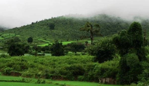
- Forested and hilly terrain in the southern part
The southern landscape forms part of the Vindhyan region.
History of Chandauli District
Chandauli has a history closely connected with the larger Varanasi and eastern Uttar Pradesh region.
The region was influenced by several ancient and medieval kingdoms and later came under Mughal and British control.
Mughal and British Period
The nearby town of Mughalsarai developed as an important transport and railway centre during the British period.
The railway network played a major role in connecting eastern Uttar Pradesh with Bihar, Bengal and northern India.
Formation of Chandauli District
Chandauli became a separate district in 1997, after being carved out of the former Varanasi district.
The creation of the district was intended to improve administration and provide government services closer to the local population.
Population of Chandauli District
According to the 2011 Census, Chandauli district had a population of approximately 19.53 lakh.
A large portion of the population lives in rural areas and depends on agriculture and related activities.
Important population and commercial centres include:
- Chandauli
- Mughalsarai
- Chakia
- Sakaldiha
- Saiyadraja
- Dhanapur
Economy of Chandauli District
Chandauli has a mixed economy based on agriculture, rice production, trade, transportation and tourism.
Major sectors include:
- Agriculture
- Rice milling
- Food processing
- Trade
- Transport
- Retail
- Construction
- Tourism
- Small-scale industries
The district benefits significantly from its location near Varanasi and the Bihar border.
Agriculture in Chandauli District
Agriculture is one of the most important economic activities in Chandauli.
Major crops include:
- Rice
- Wheat
- Pulses
- Oilseeds
- Vegetables
- Sugarcane
Rice is particularly important in the district.
The fertile plains and irrigation facilities support extensive paddy cultivation.
Rice Bowl of Purvanchal
Chandauli is popularly known as the “Rice Bowl of Purvanchal” because of its significant rice production.
Rice mills, grain markets, transportation businesses and agricultural services have developed around this farming economy.
Industries and Business in Chandauli District
Chandauli’s industrial and business activity is linked mainly to agriculture and transportation.
Important sectors include:
- Rice milling
- Food processing
- Agricultural trading
- Warehousing
- Transport
- Retail
- Construction
- Small manufacturing
The railway and logistics infrastructure around Mughalsarai / Pandit Deen Dayal Upadhyaya Nagar is particularly important for regional commerce.
Education in Chandauli District
Chandauli has schools, colleges and higher education institutions.
Important education centres include:
- Chandauli
- Chakia
- Mughalsarai
- Sakaldiha
The district has institutions offering education in:
- Arts
- Science
- Commerce
- Education
- Technical fields
- Professional courses
Students can also access major higher-education institutions in nearby Varanasi, which is one of the most important education centres in eastern Uttar Pradesh.
District Court in Chandauli
Chandauli has a District and Sessions Court serving the judicial needs of the district.
The district judiciary deals with:
- Civil cases
- Criminal cases
- Family matters
- Other legal proceedings
Subordinate courts serve different parts of the district.
District Hospital and Healthcare
Chandauli has government and private healthcare facilities.
Healthcare infrastructure includes:
- District-level government hospital
- Government hospitals
- Community Health Centres
- Primary Health Centres
- Private hospitals
- Clinics
- Diagnostic centres
The District Hospital, Chandauli provides important healthcare services to residents.
For advanced specialised medical care, residents may also travel to Varanasi, which has major hospitals and medical institutions.
Popular Tourist Attractions in Chandauli District
Chandauli is particularly attractive for visitors interested in waterfalls, forests, wildlife and religious sites.
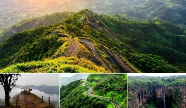
- Chandra Prabha Wildlife Sanctuary
Chandra Prabha Wildlife Sanctuary is one of the district’s most important natural attractions.
The sanctuary is known for:
- Forests
- Hills
- Waterfalls
- Wildlife
- Scenic landscapes
It provides an opportunity to experience the natural environment of the Vindhyan region.
- Devdari Waterfall
Devdari Waterfall is one of the most popular tourist attractions in Chandauli.
The waterfall is located inside the Chandra Prabha region and is surrounded by forests and rocky landscapes.
The site becomes particularly attractive during and after the monsoon.
- Rajdari Waterfall
Rajdari Waterfall is another major waterfall in the Chandra Prabha area.
The combination of flowing water, cliffs and forest makes it a popular destination for nature lovers and photographers.
Visitors should take care near waterfalls, especially during heavy rainfall.
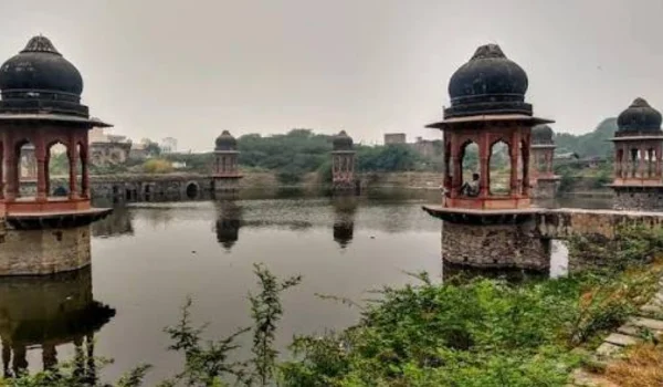
- Latif Shah Tomb
Latif Shah Tomb is a historical and religious site near Chakia.
The site is associated with Sufi saint Baba Latif Shah and attracts visitors interested in local history and spirituality.
- Latif Shah Dam
The Latif Shah Dam is located near the Latif Shah area and is surrounded by a scenic landscape.
It is visited by locals and tourists, particularly during the monsoon and cooler months.
- Chakia
Chakia is an important town and a gateway to several natural attractions in the southern part of the district.
It is useful as a base for visiting waterfalls and forest areas.
Religious and Cultural Heritage
Chandauli has a diverse religious and cultural identity.
Important religious places include:
- Latif Shah
- Shiva temples
- Devi temples
- Hanuman temples
- Local village shrines
Major festivals include:
- Diwali
- Holi
- Dussehra
- Navratri
- Maha Shivaratri
- Chhath Puja
- Eid
The district’s proximity to Varanasi also connects it closely with the broader religious culture of the Ganga region.
Transport and Connectivity
Chandauli has excellent railway and road connectivity because of its location near Varanasi and the Bihar border.
Road Connectivity
Roads connect the district with:
- Varanasi
- Ghazipur
- Mirzapur
- Sonbhadra
- Bihar
- Prayagraj
National and state highways provide access to important cities.
Railway Connectivity
Pandit Deen Dayal Upadhyaya Junction, formerly known as Mughalsarai Junction, is one of the most important railway junctions in India.
It connects major railway routes between:
- Delhi
- Varanasi
- Kolkata
- Patna
- Prayagraj
- Other parts of North and East India
This makes the Chandauli region strategically important for passenger and freight transportation.
Air Connectivity
The nearest major airport is Lal Bahadur Shastri International Airport, Varanasi.
The airport is located close enough to make air travel convenient for visitors coming to Chandauli.
Best Time to Visit Chandauli
The best time to visit Chandauli is generally October to March.
These months are suitable for:
- Waterfall visits
- Wildlife tourism
- Forest sightseeing
- Temple visits
- Local exploration
The monsoon season can make Devdari and Rajdari Waterfalls particularly impressive, but heavy rainfall can also make forest roads and waterfall areas slippery or unsafe.
Nearby Cities, Districts and Areas
Important nearby places include:
- Varanasi
- Mirzapur
- Ghazipur
- Sonbhadra
- Prayagraj
- Sasaram
- Bhabua
- Patna
Chandauli’s location gives it strong connectivity between eastern Uttar Pradesh and Bihar.
Why Is Chandauli District Important?
Chandauli is important because it combines agriculture, railway connectivity, forests, waterfalls and tourism.
Its major strengths include:
- Rice production
- Chandra Prabha Wildlife Sanctuary
- Devdari Waterfall
- Rajdari Waterfall
- Pandit Deen Dayal Upadhyaya Junction
- Ganga River region
- Proximity to Varanasi
- Strong agricultural economy
The district has potential for agro-processing, logistics, eco-tourism, hospitality, warehousing and local businesses.
FAQs About Chandauli District
- What is Chandauli district famous for?
Chandauli is famous for Chandra Prabha Wildlife Sanctuary, Devdari and Rajdari waterfalls, rice production and its important railway connectivity.
- What is the district headquarters of Chandauli?
Chandauli town is the district headquarters.
- What is the PIN code of Chandauli?
The main PIN code of Chandauli is 232104. Other towns and villages have different PIN codes.
- When was Chandauli district formed?
Chandauli was formed as a separate district in 1997 after being carved out of Varanasi district.
- What are the popular tourist places in Chandauli?
Popular attractions include Chandra Prabha Wildlife Sanctuary, Devdari Waterfall, Rajdari Waterfall, Latif Shah Tomb and Latif Shah Dam.
- Does Chandauli have a district court and district hospital?
Yes. Chandauli has a District and Sessions Court and government healthcare facilities, including district-level healthcare services, community health centres and primary health centres.
Conclusion
Chandauli District is an important district of eastern Uttar Pradesh, combining a strong agricultural economy with forests, waterfalls, religious sites and major railway infrastructure. Its identity as the “Rice Bowl of Purvanchal” highlights the importance of agriculture, while Pandit Deen Dayal Upadhyaya Junction gives the region major transportation significance.
The natural attractions of Chandra Prabha Wildlife Sanctuary, Devdari Waterfall and Rajdari Waterfall make the district an attractive destination for nature and eco-tourism. Its close proximity to Varanasi and Bihar further strengthens its economic and strategic importance.
With opportunities in agriculture, logistics, tourism, food processing and hospitality, Chandauli has considerable potential for future economic development.