Udalguri District is a scenic district in the northern part of Assam, located along the foothills of the eastern Himalayas. It shares an international boundary with Bhutan and a state boundary with Arunachal Pradesh, giving it important geographical and strategic significance.
The district is known for its diverse ethnic communities, tea gardens, forests, wildlife, religious traditions and natural attractions. Bhairabkunda, Bornadi Wildlife Sanctuary, Gethsemane Man-Made Forest and the district’s tea estates are among its notable attractions.
Quick Information About Udalguri District
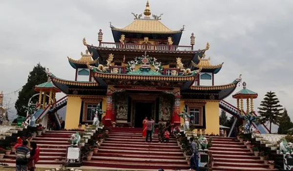
| Particular | Details |
| District | Udalguri |
| State | Assam |
| Division | North Assam |
| District Headquarters | Udalguri |
| Formation | 14 June 2004 |
| Area | 1,985.68 sq. km |
| Population | 8,31,668 |
| Literacy Rate | 65.41% as per Census 2011 |
| Sub-Divisions | 2 |
| Revenue Circles | 5 |
| Development Blocks | 11 |
| Main Languages | Bodo, Assamese, Bengali, Sadri, Nepali and others |
| Major Rivers/Water Systems | Dhansiri, Bornadi and other foothill streams |
| Famous For | Bhutan border, tea gardens, forests, wildlife and Bhairabkunda |
| Important Towns | Udalguri, Tangla and Kalaigaon |
The official district profile records a geographical area of 1,985.68 sq. km and a 2011 Census population of 8,31,668. The district headquarters is Udalguri town.
Important PIN Codes in Udalguri District
PIN codes differ according to individual post offices and localities. Some commonly used PIN codes in the district include:
| Area/Town | PIN Code |
| Udalguri | 784509 |
| Tangla | 784521 |
| Kalaigaon | 784525 |
| Mazbat | 784507 |
| Harisinga | 784510 |
| Rowta | 784508 |
| Bhairabkunda | 784510 |
| Khoirabari | 784522 |
| Paneri | 784523 |
| Dimakuchi | 784526 |
| Orang | 784114 |
| Dalgaon | 784116 |
PIN codes can vary between nearby villages and post offices. The exact code should therefore be checked according to the particular postal address before use in official documents.
Important Facts About Udalguri District
Here are some useful facts that make Udalguri distinctive:
- Udalguri is located in northern Assam.
- It shares an international boundary with Bhutan.
- It also shares a northern boundary with Arunachal Pradesh.
- The district was formally inaugurated on 14 June 2004.
- It was carved out of the erstwhile Darrang district.
- Udalguri is one of the districts under the Bodoland Territorial Region.
- The district headquarters is Udalguri town.
- It has 2 sub-divisions and 5 revenue circles.
- The district has 11 development blocks.
- The 2011 Census population was 8,31,668.
- Udalguri has a highly diverse ethnic and religious population.
- Bodos form the largest ethnic community according to the district’s official profile.
- Tea gardens and agriculture are important parts of the local economy.
- Bhairabkunda is an important natural and recreational destination.
- Bornadi Wildlife Sanctuary is one of the important protected areas associated with the district.
- The district has part of Manas National Park within its broader geographical region.
- The foothills, forests and Bhutan-border landscape give Udalguri strong tourism potential.
The official district profile describes Udalguri as a multi-ethnic and multi-religious district, with Bodo, Adivasi, Bengali Muslim, Assamese, Bengali Hindu and Nepali-speaking communities among its major population groups.
Location and Geography
Udalguri is situated in the northern part of Assam along the foothills of the Bhutan Himalayas. Its location between the plains of Assam and the Himalayan foothills gives it a distinctive landscape.
The district shares boundaries with:
- Bhutan towards the north
- Arunachal Pradesh towards the north and northeast
- Sonitpur District towards the east
- Baksa District towards the west
- Darrang District towards the south
Important geographical features include:
- Himalayan foothills
- Forest areas
- Tea gardens
- Agricultural plains
- Rivers and mountain streams
- Wildlife habitats
- Bhutan-border landscape
- Forested areas around Bhairabkunda
The district’s northern areas are more closely influenced by the foothill environment, while the southern parts form part of the wider Brahmaputra valley landscape.
History of Udalguri District
Formation of the District
Udalguri was earlier a civil sub-division of the former Darrang district. Following the political and administrative developments associated with the Bodoland movement and the formation of the Bodoland Territorial Council, Udalguri became one of the new districts.
The district was notified in 2003 and formally inaugurated on 14 June 2004.
Origin of the Name
The name Udalguri has different traditional explanations. One interpretation connects it with the Odal tree, with the name referring to an area around or associated with the tree.
Another local tradition connects the name with a hermitage associated with Uddalak Muni. The tree-based explanation is also reflected in the district’s historical account.
Historical and Cultural Development
The region has historically been home to several ethnic communities, particularly Bodos and other indigenous and tea-garden communities.
The cultural landscape developed through interactions among tribal traditions, Assamese culture, Hindu religious practices, Christian communities and communities connected with tea plantations.
Freedom Movement
Udalguri also has connections with India’s freedom movement. The district administration notes Jojaram Sharma as one of the prominent freedom fighters from the region.
The broader Assam freedom movement influenced local communities and contributed to the political development of the region.
Population of Udalguri District
According to the 2011 Census, Udalguri District had a population of 8,31,668, including 4,21,617 males and 4,10,051 females. The sex ratio was approximately 973 females per 1,000 males. Census-based sources place the literacy rate at about 65.41%.
The district has a predominantly rural population. Only a small share of residents lived in urban areas in the 2011 Census.
The population is socially and culturally diverse, with Bodo, Adivasi, Assamese, Bengali, Nepali-speaking and other communities contributing to the district’s identity.
Economy of Udalguri District
The economy of Udalguri is largely based on agriculture, tea, forestry, livestock, small businesses and rural trade.
Major economic activities include:
- Agriculture
- Tea cultivation and processing
- Forestry
- Livestock
- Horticulture
- Small-scale industries
- Handicrafts
- Local trade
- Tourism
- Transport and services
The district’s location near Bhutan also gives some areas importance for cross-border trade and regional movement.
Agriculture in Udalguri District
Agriculture remains an important source of livelihood, particularly in rural areas.
Major agricultural activities include:
- Paddy cultivation
- Maize
- Mustard
- Pulses
- Vegetables
- Fruits
- Horticultural crops
- Tea cultivation
- Livestock and dairy activities
The fertile plains and water resources support agriculture, while the foothill areas provide suitable conditions for tea gardens and horticultural activities.
Handloom and Traditional Industries
Traditional crafts and community-based production form part of Udalguri’s rural economy.
The district is particularly known for the cultural traditions of its Bodo and other indigenous communities. Traditional weaving, textiles, bamboo and cane products, food processing and handicrafts are among the activities found in the region.
Traditional clothing and weaving also have cultural importance among the Bodo community.
Industries and Business in Udalguri District
Industrial development in Udalguri is more limited than in the major industrial districts of Assam. The economy is instead dominated by agriculture-based and rural industries.
Important sectors include:
- Tea processing
- Rice and grain processing
- Food processing
- Timber and forest-related activities
- Bamboo and cane products
- Handicrafts
- Small manufacturing
- Dairy and livestock
- Retail trade
- Transport
- Tourism and hospitality
Udalguri, Tangla, Kalaigaon and other market centres serve as important commercial points for surrounding rural areas.
Tea estates are particularly significant because they provide employment and contribute to the district’s agricultural and plantation economy.
Education in Udalguri District
Education has expanded significantly across the district through schools, colleges and other institutions.
Important educational activity is concentrated around:
- Udalguri
- Tangla
- Kalaigaon
- Mazbat
- Rowta
- Harisinga
- Other block and market centres
Schools and colleges serve both urban and rural populations. The district’s location within the Bodoland region also makes education important for improving employment opportunities and social development.
District Court in Udalguri
Udalguri has judicial infrastructure serving the district’s population. Court services are administered through the appropriate district and subordinate judicial establishments.
Because jurisdictions and court arrangements can change, people requiring judicial services should verify the applicable court complex and jurisdiction before visiting.
District Hospital and Healthcare
Healthcare services in Udalguri include government hospitals, community health facilities and private medical establishments.
Important categories of healthcare infrastructure include:
- District-level hospital services
- Community Health Centres
- Primary Health Centres
- Sub-centres
- Government health programmes
- Private clinics
- Diagnostic facilities
- Pharmacies
The large rural population makes primary healthcare and community-level medical services particularly important.
Popular Tourist Attractions in Udalguri District
Udalguri offers a combination of forests, wildlife, tea gardens, religious sites and border landscapes.
- Bhairabkunda Picnic Spot
Bhairabkunda is one of the best-known tourist destinations in Udalguri. It is located near the meeting region of Assam, Bhutan and Arunachal Pradesh.
The area is popular for its natural landscape, forests and picnic opportunities. Its location near the foothills makes it particularly attractive during the cooler months.
- Gethsemane Man-Made Forest
The Gethsemane Man-Made Forest at Bhairabkunda is an important example of community-led forest restoration.
The plantation developed on degraded land and became a major green attraction in the region. It demonstrates the environmental importance of community participation in forest conservation.
- Bornadi Wildlife Sanctuary
Bornadi Wildlife Sanctuary is an important protected area in the region. It is known for its forest ecosystem and wildlife.
The sanctuary forms part of the biodiversity-rich foothill landscape of northern Assam.
- Part of Manas National Park
The northern landscape of the district is connected with the wider Manas National Park and Tiger Reserve region. Manas is internationally recognised for its biodiversity, forests and wildlife.
The broader landscape provides opportunities for wildlife and nature-based tourism.
- Bathou Temple and Research Centre
The Bathou Temple and Research Centre represents the spiritual and cultural traditions of the Bodo community.
Bathouism has an important place in Bodo cultural identity, and the centre provides visitors with an opportunity to understand this indigenous religious tradition.
- Old Namghar, Udalguri
The old Namghar in Udalguri town represents the Assamese Vaishnavite religious tradition.
Namghars traditionally serve as places of worship as well as important community and cultural spaces.
- Old Hanuman Temple
The old Hanuman Temple in Udalguri town is one of the local religious attractions. It reflects the town’s longstanding Hindu religious traditions.
- Old Baptist Christian Church
The old Baptist Christian Church in Udalguri town represents the Christian heritage of the region and its diverse religious character.
- Atrimuni Ashram
Atrimuni Ashram at Adola near Ambagaon is a historic religious site listed among the district’s places of interest.
The district administration associates the ashram with an establishment dating back to around 1600.
- Mahamuni Devalaya
Mahamuni Devalaya at Mahaliapara in Mazbat is another important religious attraction. The district administration lists its establishment as dating to 1569.
It is an interesting destination for visitors exploring the historical and religious heritage of Udalguri.
Transport and Connectivity
Road Connectivity
Udalguri is connected by road with Guwahati, Mangaldai, Tezpur, Baksa, Sonitpur and other parts of Assam.
Roads also connect the district with Bhutan-border areas and important market centres such as Udalguri, Tangla and Kalaigaon.
Railway Connectivity
Rail connectivity is available through stations serving Udalguri and surrounding areas. The railway network connects the district with important towns in Assam and the wider northeastern railway system.
Rail travel is particularly useful for movement between the district’s market centres and larger cities.
Air Connectivity
The nearest major airport is Lokpriya Gopinath Bordoloi International Airport at Guwahati.
Depending on the destination within the district, road travel from Guwahati airport is required to reach Udalguri and the northern foothill areas.
Best Time to Visit Udalguri District
The best time to explore Udalguri is generally October to April, when the weather is more suitable for outdoor activities, sightseeing and nature trips.
The cooler months are particularly suitable for:
- Bhairabkunda
- Gethsemane Man-Made Forest
- Bornadi Wildlife Sanctuary
- Tea garden visits
- Religious sites
- Nature photography
- Exploring foothill landscapes
The monsoon season can bring heavy rainfall to Assam, and some forest and outdoor destinations may become difficult to access during periods of bad weather.
Nearby Cities, Districts and Areas
Important nearby places include:
- Mangaldai
- Tezpur
- Baksa District
- Darrang District
- Sonitpur District
- Bodoland Territorial Region
- Bhutan
- Arunachal Pradesh
- Tangla
- Kalaigaon
- Mazbat
- Bhergaon
- Rowta
Udalguri’s position along the Bhutan border and near the Arunachal Pradesh boundary gives it strategic, cultural and economic importance in northern Assam.
Why Is Udalguri District Important?
Udalguri is important because it combines border geography, biodiversity, agriculture, tea production and cultural diversity.
Its major strengths include:
- International border with Bhutan
- Proximity to Arunachal Pradesh
- Foothill and Himalayan landscape
- Rich ethnic diversity
- Bodo cultural heritage
- Tea gardens
- Forest resources
- Wildlife habitats
- Bhairabkunda tourism
- Agricultural economy
The district also has importance within the Bodoland Territorial Region and plays a role in the cultural and economic development of northern Assam.
FAQs About Udalguri District
Where is Udalguri District located?
Udalguri is located in northern Assam, along the foothills of the eastern Himalayas.
When was Udalguri District formed?
Udalguri was formally inaugurated as a district on 14 June 2004 after being carved out of the former Darrang district.
What is the headquarters of Udalguri District?
The district headquarters is Udalguri town.
What is the population of Udalguri District?
According to the 2011 Census, Udalguri had a population of 8,31,668.
What is Udalguri famous for?
Udalguri is known for Bhairabkunda, tea gardens, forests, wildlife, Bodo culture, its Bhutan border and natural landscapes.
Which countries or states border Udalguri?
Udalguri shares an international border with Bhutan and a northern state boundary with Arunachal Pradesh. It also borders Sonitpur, Baksa and Darrang districts of Assam.
What are the main tourist places in Udalguri?
Important attractions include Bhairabkunda, Gethsemane Man-Made Forest, Bornadi Wildlife Sanctuary, Bathou Temple and Research Centre, Atrimuni Ashram and Mahamuni Devalaya.
Conclusion
Udalguri District is a distinctive part of Assam because of its combination of Himalayan foothills, forests, tea gardens, wildlife, agriculture and cultural diversity. Its location along the Bhutan border gives it additional geographical and strategic importance.
The district’s attractions such as Bhairabkunda, Gethsemane Man-Made Forest and Bornadi Wildlife Sanctuary make it attractive for nature and eco-tourism, while its temples, namghar, church and Bathou cultural heritage reflect its multi-community character. With its rich natural resources, agricultural economy and important position within the Bodoland region, Udalguri remains an important district of northern Assam.