Alirajpur District is a tribal-dominated district in the western part of Madhya Pradesh. The district headquarters is Alirajpur, and the region is known for its hilly landscape, forests, tribal traditions, agriculture, traditional art and proximity to Gujarat and Maharashtra.
Alirajpur was created as a separate district on 17 May 2008, after being carved out of the former Jhabua district. The district lies along the southwestern edge of the Malwa Plateau and north of the Narmada River. Its cultural identity is strongly associated with Bhil and other tribal communities.
Quick Information About Alirajpur District
| Particular | Details |
| District | Alirajpur |
| State | Madhya Pradesh |
| District Headquarters | Alirajpur |
| Formation | 17 May 2008 |
| Area | 3,182 sq. km |
| Population | 7,28,999 (2011 Census) |
| Literacy Rate | 36.10% |
| Population Density | 229 persons per sq. km |
| Sex Ratio | 1,011 females per 1,000 males |
| Main Language | Hindi |
| Major River | Narmada |
| Famous For | Tribal culture, Bhil traditions, Pithora paintings, hills and forests |
| Important Towns | Alirajpur, Jobat, Sondwa, Bhabhra, Kattiwada |
The district has a predominantly rural population. According to Census 2011, about 92.2% of the population lived in rural areas, while around 7.8% lived in urban areas.
Important PIN Codes in Alirajpur District
PIN codes are useful for postal communication, government documents, business deliveries and identifying local post offices. Some important PIN codes include:
| Area/Town | PIN Code |
| Alirajpur | 457887 |
| Jobat | 457990 |
| Bhabhra | 457882 |
| Sondwa | 457888 |
| Kattiwada | 457885 |
| Chandra Shekhar Azad Nagar | 457882 |
| Nanpur | 457887 |
| Ambua | 457993 |
| Borjhada | 457887 |
| Khattali | 457887 |
PIN codes may differ between nearby villages and individual post offices, so the exact locality should be checked before sending important postal material.
Important Facts About Alirajpur District
Here are some useful facts that make Alirajpur distinctive:
- Alirajpur became a separate district on 17 May 2008.
- Alirajpur city is the district headquarters.
- The district has an area of about 3,182 sq. km.
- Alirajpur was historically associated with the former Alirajpur princely state.
- The district is located in western Madhya Pradesh near Gujarat and Maharashtra.
- The region has a predominantly tribal population.
- The Bhil community has a major cultural presence.
- Pithora painting is an important traditional art form of the region.
- The district has a hilly and forested geographical landscape.
- The Narmada River is important to the southern part of the region.
- Agriculture and forest-based livelihoods are important to rural communities.
- Jobat, Sondwa, Kattiwada and Bhabhra are important administrative areas.
- Tribal festivals, traditional dress, music and dance form an important part of local culture.
- The district shares boundaries with areas of Gujarat and Maharashtra.
- Alirajpur is part of the Indore administrative division.
Location and Geography
Alirajpur is situated in western Madhya Pradesh. It lies along the southwestern margin of the Malwa Plateau and north of the Narmada River. The terrain is predominantly hilly, with forests, valleys and agricultural areas spread across the district.
The district shares boundaries with:
- Dhar District in the east
- Barwani District in the east and southeast
- Jhabua District in the north
- Gujarat in the west
- Maharashtra toward the south
Important geographical features include:
- Hilly terrain
- Forested areas
- Malwa Plateau margins
- Narmada river region
- Agricultural valleys
- Tribal villages
- Undulating landscapes
The geography has influenced settlement patterns, agriculture, transport and the traditional lifestyle of local communities.
History of Alirajpur District
Early History
The history of the Alirajpur region is closely connected with indigenous tribal communities, particularly the Bhils. Tribal rulers and local chiefs exercised authority over different parts of the region before the establishment of modern administrative systems.
The area developed its own social institutions, customary practices, festivals and artistic traditions.
Alirajpur Princely State
Alirajpur town served as the capital of the former Alirajpur princely state. The state existed under the broader political arrangements of Central India during the colonial period.
The region remained strongly connected with tribal society even while princely and colonial administrative structures operated in the area.
After Independence
After India became independent in 1947, the former Alirajpur territory was integrated into the Indian Union. It subsequently became part of Madhya Bharat and, after the formation of present-day Madhya Pradesh in 1956, became part of Jhabua district.
Formation of Alirajpur District
For many years, local representatives and residents demanded a separate district because of the area’s geographical and administrative characteristics.
On 17 May 2008, the Madhya Pradesh government created Alirajpur as a separate district by reorganising territory from Jhabua. Alirajpur then became an independent administrative unit with its own district headquarters.
Population of Alirajpur District
According to the 2011 Census, Alirajpur had a population of 7,28,999. The district recorded a population density of 229 persons per sq. km and a sex ratio of 1,011 females per 1,000 males.
The district is predominantly rural, with only about 7.8% of the population living in urban areas. The literacy rate recorded in the 2011 Census was 36.10%.
The population is largely tribal, with Scheduled Tribes forming a very large share of the district’s population. Communities such as Bhil groups have a major influence on the social and cultural character of the region.
Economy of Alirajpur District
The economy of Alirajpur is mainly based on agriculture, horticulture, forestry, livestock, small trade and government services.
Important economic activities include:
- Agriculture
- Horticulture
- Forest-based livelihoods
- Livestock rearing
- Local markets
- Small businesses
- Handicrafts
- Traditional art
- Tourism
- Government and public services
Because much of the district is rural, agriculture and allied activities remain important sources of livelihood.
Agriculture in Alirajpur
Agriculture is a major part of the rural economy. Farming practices vary according to rainfall, soil, terrain and access to irrigation.
Common agricultural activities include cultivation of:
- Maize
- Wheat
- Pulses
- Soybean
- Cotton in suitable areas
- Vegetables
- Seasonal crops
Farmers also depend on livestock and forest resources. The hilly terrain means that farming conditions are different from those in the large agricultural plains of central Madhya Pradesh.
Handloom and Traditional Industries
Alirajpur is particularly known for its tribal art and cultural traditions rather than large-scale handloom industries.
Pithora Painting
Pithora painting is one of the most distinctive traditional art forms associated with the tribal communities of western Madhya Pradesh and neighbouring regions.
These paintings traditionally have ritual and cultural significance and use symbolic figures, animals, nature and community-related themes.
Tribal Crafts
Local communities also produce:
- Bamboo and cane articles
- Traditional ornaments
- Decorative items
- Handcrafted household products
- Traditional textiles
- Tribal paintings
These crafts help preserve local cultural identity and can also provide supplementary income for rural households.
Industries and Business in Alirajpur
Alirajpur does not have a major heavy-industry base. Its business environment is more closely connected with agriculture, forestry, local trade, food processing, transport and small enterprises.
Important business sectors include:
- Agricultural trading
- Food and agro-processing
- Retail markets
- Transport services
- Construction
- Small manufacturing
- Handicrafts
- Tourism and hospitality
- Livestock-related activities
- Government services
Alirajpur town is the main administrative and commercial centre, while Jobat, Sondwa, Bhabhra and Kattiwada serve as important local market and service centres.
Education in Alirajpur
Education facilities in the district include government and private schools, higher secondary institutions and colleges.
The district has educational institutions serving both urban and rural populations. Improving educational access is particularly important because many communities live in remote and hilly villages.
Higher education facilities are concentrated mainly around Alirajpur and other major towns. Government programmes also focus on improving school infrastructure, enrolment and educational opportunities for tribal communities.
District Court in Alirajpur
Alirajpur is the administrative headquarters and an important centre for judicial and legal services in the district.
The district’s judicial system handles civil, criminal and other matters under the applicable judicial framework. Court-related services are supported by the appropriate district-level legal and administrative institutions.
People travelling for a specific court matter should confirm the current court location, working hours and case-related requirements before visiting.
District Hospital and Healthcare
Healthcare services are provided through government hospitals and a network of health facilities across the district.
Important healthcare infrastructure includes:
- District-level hospital services
- Community Health Centres
- Primary Health Centres
- Sub-health centres
- Maternal and child healthcare services
- Immunisation services
- Rural health programmes
- Emergency and referral services
The district administration continues to face the challenge of providing healthcare access across scattered villages and hilly terrain.
Popular Tourist Attractions in Alirajpur
Alirajpur offers a different tourism experience from the major heritage cities of Madhya Pradesh. Its main attractions are connected with tribal culture, rivers, hills, forests, traditional art and rural landscapes.
- Alirajpur Town
Alirajpur is the administrative headquarters and the main urban centre of the district. Visitors can explore local markets and experience the everyday cultural environment of western Madhya Pradesh.
- Kattiwada
Kattiwada is known for its green surroundings, rural landscapes and agricultural environment. The area is also associated with the cultural traditions of local tribal communities.
- Jobat
Jobat is one of the important towns of the district. It has historical and administrative significance and serves as a local commercial centre for surrounding villages.
- Sondwa
Sondwa is a prominent administrative area surrounded by the district’s characteristic hilly landscape. It provides an opportunity to experience rural and tribal life in western Madhya Pradesh.
- Narmada River Region
The southern part of Alirajpur is influenced by the Narmada river system. The river landscape and surrounding hills provide opportunities for nature-oriented travel and local sightseeing.
- Kakrana
Kakrana is associated with the Narmada region and is known for its scenic surroundings. The area is particularly interesting for travellers who want to explore less-commercialised rural landscapes.
- Tribal Villages and Cultural Areas
The villages of Alirajpur provide opportunities to understand the traditions, architecture, festivals, clothing and daily life of local tribal communities.
- Pithora Art and Cultural Heritage
Traditional Pithora painting is an important cultural attraction. Visitors interested in indigenous art can learn about the symbolic and ritual traditions behind this form of painting.
- Forest and Hill Landscapes
The district’s forests and hills provide a natural setting for rural and nature tourism. Travel through the interior areas can offer views of valleys, agricultural fields and tribal settlements.
- Local Tribal Festivals
Traditional tribal festivals, fairs, music and dance are an important part of Alirajpur’s cultural tourism. Festival dates vary each year, so visitors should check the local calendar before planning a trip.
Transport and Connectivity
Road Connectivity
Road transport is the main way to travel around Alirajpur District. Alirajpur, Jobat, Sondwa, Kattiwada and Bhabhra are connected by roads to neighbouring districts and Gujarat.
Road travel is particularly important because many villages are spread across hilly and rural areas.
Railway Connectivity
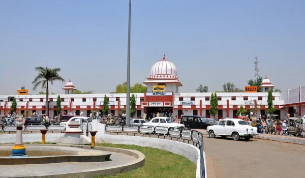
Alirajpur Railway Station provides rail connectivity for the district. Rail connections can also be accessed through nearby railway stations depending on the travel route.
Air Connectivity
The district does not have a major commercial airport. Travellers generally use airports in larger nearby cities and continue their journey by road or rail.
Best Time to Visit Alirajpur
The cooler months from October to February are generally comfortable for exploring Alirajpur’s towns, villages, cultural attractions and natural surroundings.
Visitors can consider:
- Exploring tribal cultural areas
- Visiting Narmada-region landscapes
- Seeing traditional Pithora art
- Exploring local markets
- Visiting rural and forested areas
- Attending local fairs and festivals
- Exploring nearby historical and cultural sites
Summer can be hot, while the monsoon season brings greener landscapes but can make travel on some rural roads more difficult.
Nearby Cities, Districts and Areas
Important nearby areas include:
- Jhabua District
- Dhar District
- Barwani District
- Gujarat
- Maharashtra
- Jobat
- Sondwa
- Kattiwada
- Bhabhra
- Kukshi
- Manawar
- Barwani
Alirajpur’s location near state borders gives it importance for regional trade, cultural interaction and movement between Madhya Pradesh, Gujarat and Maharashtra.
Why Is Alirajpur District Important?
Alirajpur is important because of its unique combination of tribal heritage, geographical location, agriculture, traditional art and natural landscapes.
Its major strengths include:
- Strong tribal cultural identity
- Bhil heritage
- Traditional Pithora painting
- Hilly and forested geography
- Proximity to Gujarat and Maharashtra
- Narmada river landscape
- Agriculture and horticulture
- Local handicrafts
- Rural tourism potential
- Historical connection with the former Alirajpur princely state
The district is also significant for inclusive development because a large proportion of its population lives in rural and tribal communities.
FAQs About Alirajpur District
When was Alirajpur District formed?
Alirajpur became a separate district of Madhya Pradesh on 17 May 2008 after being carved out of Jhabua district.
What is the headquarters of Alirajpur District?
The headquarters of Alirajpur District is Alirajpur city.
What is Alirajpur famous for?
Alirajpur is famous for its tribal culture, Bhil traditions, Pithora paintings, hills, forests and Narmada-region landscapes.
What is the population of Alirajpur District?
According to the 2011 Census, Alirajpur had a population of 7,28,999.
What is the area of Alirajpur District?
The district covers approximately 3,182 sq. km.
Which river is important in Alirajpur?
The Narmada River is an important geographical feature of the region, particularly toward the southern part of the district.
Which districts border Alirajpur?
Alirajpur borders Dhar, Barwani and Jhabua in Madhya Pradesh and also has boundaries with Gujarat and Maharashtra.
Conclusion
Alirajpur District is an important tribal and cultural region of western Madhya Pradesh. Its history is connected with the former Alirajpur princely state, while its modern identity developed after the district was separated from Jhabua in 2008.
The district is characterised by hills, forests, rural settlements, agriculture, traditional art and strong tribal traditions. With its Pithora paintings, Narmada landscapes and distinctive cultural heritage, Alirajpur offers a different and valuable perspective on the geography and culture of Madhya Pradesh.