Amroha District is located in western Uttar Pradesh and is known for its historical city of Amroha, traditional dholak manufacturing, mangoes, agriculture and religious heritage. The district lies close to Moradabad and has good road and railway connectivity with important cities of western Uttar Pradesh and Delhi-NCR.
Amroha has a mix of historic settlements, agricultural villages, industrial centres and religious sites. Gajraula, Amroha, Hasanpur, Dhanaura and Naugawan Sadat are among its important urban centres. The Ganga River forms an important geographical feature along the western side of the district.
Quick Information About Amroha District
| Particular | Details |
| District | Amroha |
| State | Uttar Pradesh |
| District Headquarters | Amroha |
| Formation | 15 April 1997 |
| Area | About 2,249 sq. km. |
| Population | 18,40,221 (Census 2011) |
| Literacy Rate | About 64.8% (Census 2011) |
| Tehsils | 4 |
| Main Language | Hindi |
| Major Rivers | Ganga, Krishna and Baha |
| Famous For | Dholak, mangoes, traditional crafts and religious heritage |
| Important Towns | Amroha, Gajraula, Hasanpur, Dhanaura, Naugawan Sadat, Bachhraon |
Amroha was created as a separate district in 1997 by separating the Amroha, Dhanaura and Hasanpur tehsils from the former Moradabad district. Naugawan Sadat is now the fourth tehsil of the district.
Important PIN Codes in Amroha District
PIN codes are useful for postal services, government documents, online deliveries and identifying particular towns or localities. Some important PIN codes in Amroha district are:
| Area / Town | PIN Code |
| Amroha | 244221 |
| Joya | 244222 |
| Bachhraon | 244225 |
| Dhanaura | 244231 |
| Gajraula | 244235 |
| Rajabpur | 244236 |
| Hasanpur | 244241 |
| Naugawan Sadat | 244251 |
| Adampur | 244255 |
| Ujhari | 244242 |
PIN codes can vary between neighbouring villages and individual post offices, so the exact post office should be checked before using a PIN for official correspondence.
Important Facts About Amroha District
Here are some useful facts that make Amroha distinctive:
- Amroha district was established in 1997.
- Amroha city is the district headquarters.
- The district is located in western Uttar Pradesh.
- Amroha is particularly famous for its dholak and musical instrument craftsmanship.
- Mango production is an important part of the local agricultural economy.
- Gajraula is an important industrial and commercial centre.
- The Ganga River is an important geographical and religious feature.
- Tigri is known for the annual Ganga fair held around Kartik Purnima.
- Agriculture provides livelihoods to a large part of the rural population.
- Traditional activities include dholak making, handloom work and other cottage industries.
- Sugarcane is an important agricultural crop in the region.
- The district has four tehsils: Amroha, Dhanaura, Hasanpur and Naugawan Sadat.
- Amroha has a long historical association with different ancient, medieval and colonial political powers.
- The district has a combination of Hindu, Islamic and Sufi cultural heritage.
- Its location provides access to important markets and cities of western Uttar Pradesh.
Location and Geography
Amroha is situated in the western part of Uttar Pradesh. It is positioned near Moradabad and has geographical and economic connections with several districts of the region.
The district shares boundaries with:
- Bijnor in the north
- Moradabad in the east
- Sambhal towards the south
- Hapur and neighbouring western Uttar Pradesh districts towards the west
- Areas around the Ganga are also connected geographically with districts across the river.
Important geographical features include:
- Ganga River
- Agricultural plains
- Fertile alluvial soils
- Extensive cultivated areas
- Rural villages and irrigation networks
- Ganga-side landscapes around Tigri
The district has a climate typical of western Uttar Pradesh, with hot summers, a monsoon season and comparatively cold winters.
History of Amroha District
Amroha has a long and complex history. The present district formed part of different political and cultural regions over many centuries.
Ancient History
Historical accounts associate the region with the wider Panchala area of northern India. Over different periods, the area came under the influence of major kingdoms and empires including the Nanda, Maurya and Gupta traditions.
The region was also associated with the political developments of northern India after the decline of the Gupta Empire. Later, different ruling groups controlled parts of the area.
Medieval Period
During the medieval period, Amroha became associated with the Delhi Sultanate and later Mughal administration. The district’s historical sources mention several Rajput clans and local ruling groups before stronger Sultanate and Mughal control developed.
During the Mughal period, the region was associated with the Sarkar of Sambhal under the administrative system of the empire.
The city of Amroha also developed as an important settlement and centre of trade and local culture.
Later Medieval and Colonial Period
Rohillas, Marathas and the rulers of Awadh influenced the wider region at different times. In 1801, territory in this region was ceded by the Nawab of Awadh to the British East India Company.
During British administration, the area was managed as part of the larger Moradabad administrative structure.
Formation of Amroha District
The modern district was created on 15 April 1997. It was initially known as Jyotiba Phule Nagar, while the headquarters remained at Amroha.
The district is now officially known as Amroha and has developed as an agricultural, industrial and cultural district of western Uttar Pradesh.
Population of Amroha District
According to the 2011 Census, Amroha district had a population of 18,40,221. The district had both rural and urban populations, with a substantial share of residents living in villages.
The Census recorded around 13.82 lakh people in rural areas and about 4.59 lakh in urban areas. Amroha was the largest urban centre in the district during the 2011 Census period.
Important urban centres include Amroha, Hasanpur, Gajraula, Bachhraon, Dhanaura and Naugawan Sadat.
The district has an economy strongly connected with agriculture, small-scale manufacturing, trade, services and traditional industries.
Economy of Amroha District
The economy of Amroha has a strong agricultural base along with manufacturing, trade and cottage industries.
Major economic sectors include:
- Agriculture and allied activities
- Sugarcane-related activities
- Mango cultivation and trade
- Dholak manufacturing
- Handloom and weaving
- Dairy and milk products
- Industrial manufacturing
- Trade and retail
- Transport and logistics
- Small and medium enterprises
- Religious and local tourism
Gajraula is particularly important for industrial activity, while Amroha city has a long association with handicrafts and traditional manufacturing.
Agriculture in Amroha
Agriculture is one of the main sources of livelihood in the district. The fertile plains and irrigation facilities support the cultivation of several crops.
Major agricultural activities include:
- Sugarcane cultivation
- Wheat
- Paddy
- Maize
- Pulses
- Oilseeds
- Seasonal vegetables
- Mango cultivation
Sugarcane is especially important in the agricultural economy of western Uttar Pradesh. Mangoes are another well-known agricultural product associated with Amroha.
Irrigation plays an important role in maintaining agricultural production, with a combination of canals, tube wells and other irrigation sources supporting cultivated land.
Handloom and Traditional Industries
Amroha has a strong tradition of cottage and household industries.
Dholak Manufacturing
The district is widely known for its dholak manufacturing industry. Skilled artisans produce traditional percussion instruments used in folk music, religious programmes, cultural events and performances.
Dholak making represents an important example of local craftsmanship and contributes to the cultural identity of Amroha.
Handloom and Weaving
Handloom work and cloth weaving are also associated with parts of the district. Traditional skills continue to provide employment opportunities for artisans and small producers.
Other Cottage Activities
Other local activities include pottery, dairy-related work and small-scale manufacturing.
Industries and Business in Amroha District
Amroha has a mixed industrial and commercial economy.
Gajraula is one of the most important industrial centres. Its location along major road and railway routes has helped industrial development and movement of goods.
Important business sectors include:
- Chemical and manufacturing industries
- Sugar-related industries
- Food processing
- Dairy products
- Handicrafts
- Textile and weaving
- Small manufacturing units
- Agricultural trade
- Retail markets
- Transport and logistics
The combination of agriculture, highways, railway connectivity and nearby large cities provides opportunities for MSMEs and other businesses.
Education in Amroha
Education facilities in the district include government schools, private schools, colleges and higher-education institutions.
Amroha city serves as an important educational centre for surrounding rural areas. Colleges in the district provide education in arts, science, commerce, professional and other subjects.
Students from smaller towns and villages often travel to Amroha, Moradabad and other nearby educational centres for higher and professional education.
District Court in Amroha
The District Court of Amroha serves as an important judicial institution for the district. It deals with civil, criminal and other matters falling under the jurisdiction of the district judiciary.
The judicial administration is supported by subordinate courts and related legal offices. Tehsil-level revenue courts also play an important role in handling land and revenue-related matters.
District Hospital and Healthcare
Amroha has government healthcare facilities serving both urban and rural populations.
Important healthcare infrastructure includes:
- District-level government hospital facilities
- Community Health Centres
- Primary Health Centres
- Sub-centres
- Government medical and public-health programmes
- Private hospitals and clinics in major towns
The district administration and health department also provide maternal health, immunisation, emergency and other public-health services.
Popular Tourist Attractions in Amroha District
Amroha is better known for its religious heritage, historical sites, Ganga-related tourism and traditional culture than for large commercial tourist attractions.
- Vasudev Mandir and Tulsi Park
Vasudev Mandir is an important religious site in Amroha. Local traditions associate the site with the Mahabharata period and Lord Krishna.
The surrounding area and Tulsi Park make it a notable place for visitors interested in the religious heritage of the city.
- Bayen Ka Kuan
Bayen Ka Kuan is a historic stepwell located in Amroha. It represents the older architectural and water-management traditions of the region.
The site is important for visitors interested in local history and heritage.
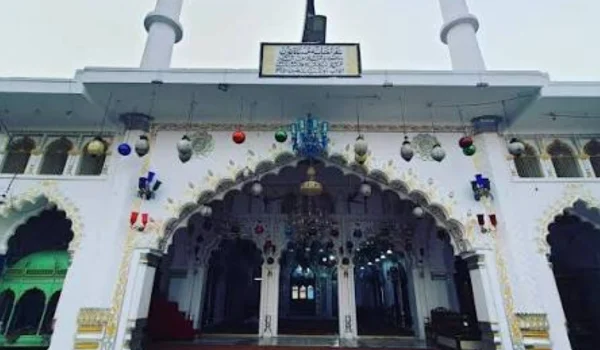
- Dargah Shah Vilayat Sahib
The Mazar of Shah Vilayat Sahib is one of the prominent Sufi heritage sites of Amroha. It reflects the city’s long tradition of Sufi culture and religious coexistence.
- Dargah Bhure Shah
Dargah Bhure Shah is another important religious and cultural site in Amroha. Such Sufi shrines form an important part of the historical identity of the city.
- Nasiruddin Sahib Ki Mazar
The shrine associated with Shah Nasiruddin Sahib is among the religious heritage locations of Amroha. It attracts visitors interested in the city’s Islamic and Sufi traditions.
- Tigri Ganga Mela
Tigri is situated on the banks of the Ganga and is famous for the annual Tigri Ganga Mela, particularly around Kartik Purnima.
Large numbers of devotees gather here for religious activities and a holy bath in the Ganga.
- Gajraula
Gajraula is an important industrial town and commercial centre. It can also serve as a convenient base for exploring parts of the district.
- Amroha Heritage Areas
The older parts of Amroha contain historic religious sites, traditional neighbourhoods, old markets and examples of local architecture.
Visitors interested in heritage can explore the city’s historic character along with its traditional crafts.
Transport and Connectivity
Road Connectivity
Amroha is connected with Moradabad, Delhi-NCR, Hapur, Bijnor and other western Uttar Pradesh cities through the regional road network.
Gajraula has an especially important location on major north Indian transport routes, making the area useful for road-based movement of passengers and goods.
Railway Connectivity
Amroha district has railway connectivity through important stations including Amroha, Gajraula, Dhanaura and Bachhraon.
The railway network connects the district with Delhi, Moradabad and other destinations in northern India.
Air Connectivity
The nearest major commercial air connectivity is generally through airports serving Delhi-NCR and other major cities of the region. Travellers should check current flight schedules and road or rail connections before planning an air journey.
Best Time to Visit Amroha District
The cooler months from October to March are generally more comfortable for exploring Amroha’s heritage and religious sites.
Good experiences during this period include:
- Exploring historic Amroha
- Visiting religious and Sufi heritage sites
- Visiting Bayen Ka Kuan
- Exploring Gajraula
- Visiting Tigri and the Ganga
- Attending the Tigri Ganga Mela when it falls during the travel period
- Exploring local markets and traditional crafts
Summer can be hot, while the monsoon season can bring humid weather and occasional water-related travel difficulties.
Nearby Cities, Districts and Areas
Important nearby cities and areas include:
- Moradabad
- Sambhal
- Bijnor
- Hapur
- Bulandshahr
- Meerut region
- Delhi-NCR
- Ganga-side areas of western Uttar Pradesh
Amroha’s location between the Delhi-NCR region and Rohilkhand makes it important for regional agriculture, trade, transportation and cultural exchange.
Why Is Amroha District Important?
Amroha is important because of its combination of historical heritage, agriculture, traditional craftsmanship, industry and religious culture.
Its major strengths include:
- Historical city of Amroha
- Traditional dholak manufacturing
- Mango production
- Strong agricultural economy
- Gajraula industrial area
- Ganga River and religious tourism
- Tigri Ganga Mela
- Sufi heritage
- Traditional handloom and cottage industries
- Good road and railway connectivity
The district represents the combination of traditional western Uttar Pradesh culture with modern agriculture, manufacturing and regional commerce.
FAQs About Amroha District
What is Amroha district famous for?
Amroha is famous for dholak manufacturing, mangoes, agriculture, religious heritage and Sufi shrines.
When was Amroha district formed?
Amroha district was formed on 15 April 1997 after being separated from Moradabad district.
What is the headquarters of Amroha district?
The district headquarters is located in Amroha city.
How many tehsils are there in Amroha district?
There are four tehsils: Amroha, Dhanaura, Hasanpur and Naugawan Sadat.
What is the population of Amroha district?
According to the 2011 Census, Amroha district had a population of 18,40,221.
Which river is important in Amroha district?
The Ganga River is one of the most important geographical and religious features of the district.
Which place in Amroha is famous for the Ganga fair?
Tigri is famous for the annual Tigri Ganga Mela, which attracts large numbers of devotees.
Conclusion
Amroha District is an important district of western Uttar Pradesh with a distinctive combination of history, agriculture, traditional craftsmanship, industry and religious heritage. The district headquarters, Amroha city, has a long historical background and is known for its cultural and Sufi heritage.
From dholak manufacturing and mangoes to Gajraula’s industrial activity and Tigri’s Ganga fair, Amroha has a diverse local identity. Its road and railway connections with major cities further strengthen its role as an important regional centre in western Uttar Pradesh.