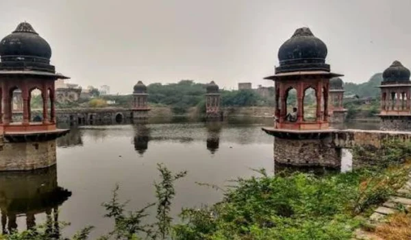
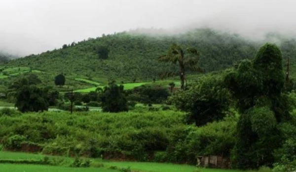
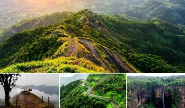
Kupwara is a scenic frontier district in the northern part of Jammu and Kashmir. Known for its lush valleys, dense forests, snow-covered mountains, rivers and meadows, the district is one of the most naturally beautiful regions of the Kashmir Valley. Lolab Valley, Bangus Valley, Keran Valley and Sadhna Pass are among its best-known attractions.
Kupwara was carved out of the erstwhile Baramulla district in 1979. Its location along the northern frontier gives it strategic importance, while its forests, agriculture, horticulture and tourism provide important economic opportunities.
Quick Information About Kupwara District
| Particular | Details |
| District | Kupwara |
| Union Territory | Jammu and Kashmir |
| District Headquarters | Kupwara |
| Formation | 1979 |
| Area | 2,379 sq. km |
| Population | 8,75,564 (Census 2011) |
| Literacy Rate | 66.92% |
| Sub-Divisions | 2 |
| Tehsils | 16 |
| Development Blocks | 24 |
| Gram Panchayats | 356 |
| Main Language | Kashmiri |
| Famous For | Lolab Valley, Bangus Valley, Keran, walnut and apple production |
| Major Rivers | Kishan Ganga, Pohru, Mawar and Batmooji |
| Major Mountain Ranges | Pir Panjal and Shams Bari |
The district administration lists an area of 2,379 sq. km and Census 2011 population of 8,75,564. The district has 16 tehsils, 24 development blocks and 356 gram panchayats.
Location and Geography of Kupwara
Kupwara is located in the northern part of Jammu and Kashmir and forms part of the Kashmir Valley. The district lies between the Pir Panjal and Shams Bari mountain ranges, giving it a landscape of mountains, valleys, forests, meadows and streams.
The district headquarters is approximately 90–110 km from Srinagar, depending on the route and reference point. Its geographical area covers 2,379 sq. km.
A significant part of the district is covered by forests. Deodar, pine and fir are among the major tree species found in the forested mountain areas.
Important rivers and streams flowing through the district include:
- Kishan Ganga
- Pohru
- Mawar
- Batmooji
- Other mountain streams and tributaries
The district’s high-altitude valleys and mountain passes also contribute to its tourism potential.
Pincode of Kupwara District
Kupwara district in Jammu and Kashmir has multiple PIN codes for different towns, villages and post offices. The Kupwara district headquarters has PIN code 193222.
| Area / Post Office | PIN Code |
| Kupwara | 193222 |
| Handwara | 193221 |
| Trehgam | 193224 |
| Tangdhar | 193225 |
| Lolab | 193223 |
| Sogam | 193223 |
| Kralpora | 193224 |
| Qaziabad | 193221 |
| Langate | 193221 |
| Zachaldara | 193221 |
History of Kupwara District
The area of present-day Kupwara was historically part of the larger Baramulla region.
Kupwara became a separate district in 1979, when it was carved out of the erstwhile Baramulla district. This created a separate administrative centre for the northern areas of the Kashmir Valley.
The region has long been connected with the traditional culture and history of Kashmir. Its valleys and mountain routes have also played an important role in movement between different parts of the northern Kashmir region.
Places such as Lolab, Karnah and Keran have their own local traditions, historical associations and cultural heritage.
Population of Kupwara District
According to Census 2011 data published by the district administration, Kupwara had a population of 8,75,564. Of this, about 7.76 lakh people lived in rural areas, while around 99,000 lived in urban areas.
The district recorded a literacy rate of 66.92% in the 2011 Census. Male literacy was 77.10%, while female literacy was 54.79%.
The large rural population reflects the importance of agriculture, horticulture, livestock and village-based economic activities in the district.
Economy of Kupwara District
Kupwara has an economy based largely on agriculture, horticulture, livestock, forestry, trade and tourism.
The district has fertile valleys and mountain slopes that support the cultivation of fruits, walnuts and other agricultural products. Horticulture is particularly important in areas such as Lolab Valley.
Major Economic Activities
- Agriculture
- Horticulture
- Apple cultivation
- Walnut production
- Livestock and sheep rearing
- Forestry
- Handicrafts
- Local trade
- Tourism and hospitality
- Small businesses
The district administration describes Kupwara as a major producer of walnuts and apples, giving horticulture an important place in the local economy.
Agriculture and Horticulture in Kupwara
Agriculture remains one of the major sources of livelihood in Kupwara.
The district has extensive agricultural and horticultural land. Important products include:
- Apples
- Walnuts
- Pears
- Cherries
- Peaches
- Vegetables
- Maize
- Paddy
- Other temperate crops
Kupwara is popularly associated with its walnut production and is sometimes referred to as the “Walnut District.” The Lolab Valley is particularly known for its orchards and green landscapes.
Industries and Business in Kupwara
Kupwara does not have the large industrial base of major urban districts, but there are opportunities in agriculture-linked businesses, horticulture, food processing, handicrafts, tourism and local trade.
Business Opportunities
Potential sectors include:
- Fruit processing
- Walnut processing and packaging
- Cold storage
- Agriculture-based businesses
- Handicrafts
- Tourism and homestays
- Hotels and restaurants
- Transport services
- Retail and wholesale trade
- Small-scale manufacturing
The development of horticulture and tourism can provide further opportunities for local entrepreneurs.
Education in Kupwara
Kupwara has schools, colleges and other educational institutions serving the district’s large rural population.
The district has institutions such as:
- Government Degree College, Kupwara
- Government Women’s Degree College, Sulkoot
- Government Degree College, Sogam
- Government Polytechnic College, Kupwara
- Schools and higher-secondary institutions across different areas
The district administration’s public utilities directory lists educational institutions in Kupwara and surrounding areas.
District Court in Kupwara
Kupwara has a District and Sessions Court serving the district.
The separate district judiciary began functioning after Kupwara became an independent district. The Court of Principal District and Sessions Judge started functioning in Kupwara on 1 March 1980.
The district judicial system also includes subordinate courts serving different parts of Kupwara.
District Hospital and Healthcare
Kupwara has a network of government healthcare facilities serving both urban and rural populations.
The district’s public healthcare network includes:
- Kupwara District Hospital
- District Hospital Handwara
- Sub-District Hospital, Kupwara
- Other sub-district hospitals
- Community Health Centres
- Primary Health Centres
The official district public utilities directory lists both Kupwara District Hospital and District Hospital Handwara.
The district health department also identifies medical administration and healthcare facilities across Kupwara, including hospitals at Kupwara and Handwara.
Popular Tourist Attractions in Kupwara
Kupwara is particularly attractive for travellers who enjoy mountains, valleys, forests, meadows, rivers and offbeat Kashmir destinations.
- Lolab Valley
Lolab Valley is one of the most beautiful destinations in Kupwara. Located close to Kupwara town, the valley is known for its green meadows, forests, orchards, streams and traditional villages.
Apple, walnut, cherry and other fruit crops are grown in the valley. The district tourism website describes Lolab as a major natural attraction extending across several villages.
- Bangus Valley
Bangus Valley, also known as Bangus, is a high-altitude meadow region surrounded by mountains.
The valley is known for its wide grasslands, forests, streams and mountain scenery. It is considered one of the major tourism destinations with significant potential in Kupwara.
- Keran Valley
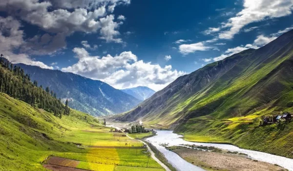
Keran is a scenic valley located along the Kishan Ganga River.
The region is surrounded by mountains and offers beautiful views of the river and surrounding landscape. Its location near the frontier makes it a distinctive destination, and visitors may need to follow applicable travel and permission requirements.
- Sadhna Pass
Sadhna Pass, formerly known as Nastachun Pass, is a high mountain pass connecting the Karnah region with the rest of the Kashmir Valley.
Located in the Shams Bari range, the pass is known for dramatic mountain scenery and the Sadhna Pass View Point.
- Seemab Valley
Seemab Valley is located near the entrance to the Lolab Valley and is known for its natural surroundings.
Its proximity to Kupwara makes it one of the more accessible scenic attractions in the district. The official tourism portal lists Seemab Valley among Kupwara’s tourist places.
- Satbaran Kalaroos
Satbaran Kalaroos is associated with ancient caves and rock formations in the Kalaroos area of Lolab.
The site has local historical traditions and legends surrounding the caves, making it an interesting destination for visitors exploring the less-known attractions of Kupwara.
- Muqam Shah Wali
Muqam Shah Wali is a religious and cultural destination associated with the shrine of Zaiti Shah Wali.
An annual gathering is held at the shrine, attracting visitors from different communities. The site is located close to Kupwara town.
- Machil Valley
Machil is a scenic mountain valley in the northern part of Kupwara district.
The region is surrounded by mountains and forests and is known for its remote natural setting. Travel conditions can vary considerably with the season, particularly during winter.
Transport and Connectivity
Kupwara has road connectivity with Srinagar, Baramulla, Handwara and other parts of the Kashmir Valley. However, travel to some high-altitude and frontier areas can be affected by heavy snowfall and seasonal road conditions.
Road Connectivity
Roads connect Kupwara town with Srinagar and neighbouring districts. Roads also lead towards Lolab, Handwara, Karnah, Keran and other parts of the district.
Some remote frontier areas can remain inaccessible or difficult to reach during periods of heavy snowfall.
Railway Connectivity
Kupwara does not have a major railway station within the district. Travellers generally use railway stations in other parts of the Kashmir Valley and continue their journey by road.
Air Connectivity
The nearest major airport for travellers is Srinagar International Airport.
From Srinagar, visitors can continue towards Kupwara by road.
Best Time to Visit Kupwara
The best time to visit depends on the destination.
For valleys, meadows and general sightseeing, May to October is generally more suitable. The warmer months bring greener landscapes and better access to many high-altitude destinations.
For snow lovers, winter can offer a very different experience, but heavy snowfall can also close mountain passes and restrict access to remote areas.
Visitors planning trips to frontier areas such as Keran, Karnah and Machil should check current travel advisories, road conditions and permission requirements before travelling.
Nearby Cities, Districts and Areas
Kupwara is connected with several important places in the Kashmir region.
Nearby areas include:
- Srinagar
- Baramulla
- Handwara
- Sopore
- Bandipora
- Tangmarg
- Lolab
- Karnah
- Keran
- Machil
Srinagar remains the main urban centre for many major transport, healthcare, education and commercial requirements.
Why Is Kupwara District Important?
Kupwara is important because of its strategic frontier location, natural beauty, forests, agriculture and tourism potential.
Its major highlights include:
- Location in northern Jammu and Kashmir
- Strategic frontier position
- Pir Panjal and Shams Bari mountain ranges
- Lolab Valley
- Bangus Valley
- Keran Valley
- Sadhna Pass
- Extensive forests
- Apple and walnut production
- Important rivers and mountain streams
- Rich wildlife and natural landscapes
The district’s combination of geographical importance and natural beauty makes it one of the distinctive regions of Jammu and Kashmir.
FAQs About Kupwara District
When was Kupwara district formed?
Kupwara was carved out of the erstwhile Baramulla district in 1979.
What is Kupwara district famous for?
Kupwara is famous for Lolab Valley, Bangus Valley, Keran Valley, Sadhna Pass, forests, apples and walnuts.
What is the area of Kupwara district?
Kupwara district covers approximately 2,379 square kilometres.
What is the population of Kupwara district?
According to Census 2011 data, Kupwara had a population of 8,75,564.
What are the popular tourist places in Kupwara?
Popular attractions include Lolab Valley, Bangus Valley, Keran Valley, Sadhna Pass, Seemab Valley, Satbaran Kalaroos and Machil Valley.
Does Kupwara have a district court and district hospital?
Yes. Kupwara has a District and Sessions Court, while healthcare facilities include Kupwara District Hospital and District Hospital Handwara, along with several sub-district and primary healthcare facilities.
Conclusion
Kupwara District is a unique part of Jammu and Kashmir, combining spectacular Himalayan landscapes with an important frontier location and a largely rural economy. Its valleys, forests, mountain passes and rivers make it particularly attractive for nature and adventure tourism.
Lolab Valley, Bangus Valley, Keran and Sadhna Pass are among its most notable attractions, while apples, walnuts, agriculture and livestock remain important to the local economy. With its distinctive geography, rich natural environment and cultural heritage, Kupwara holds an important place in the northern Kashmir region.