Belagavi District is a major historical, cultural and economic district in northern Karnataka. The district headquarters is Belagavi city, which is also known for its location near the borders of Maharashtra and Goa. The region has a strong blend of Kannada, Marathi and Konkani cultural influences.
Belagavi is known for its historic forts, temples, waterfalls, agricultural economy, engineering industries, sugar factories and educational institutions. The district lies partly in the Western Ghats and has a varied landscape ranging from green hills and forests to fertile agricultural plains.
Quick Information About Belagavi District
| Particular | Details |
| District | Belagavi |
| State | Karnataka |
| District Headquarters | Belagavi |
| Area | 13,433 sq. km |
| Population | 47,79,661 (2011 Census) |
| Literacy Rate | 75.4% |
| Revenue Sub-Divisions | 3 |
| Taluks | 13 in the current district administration |
| Main Languages | Kannada, Marathi and other regional languages |
| Major Rivers | Krishna, Ghataprabha, Malaprabha and Markandeya |
| Famous For | Forts, waterfalls, temples, sugar industry, engineering and agriculture |
| Important Cities/Towns | Belagavi, Gokak, Chikkodi, Athani, Nippani, Bailhongal, Savadatti, Khanapur, Hukkeri and Ramdurg |
The district administration records an area of 13,433 sq. km and a 2011 population of 47,79,661. The district’s official demographic page lists 3 revenue sub-divisions and 10 taluks in the 2011 administrative structure, while the current district portal also lists newer administrative units such as Kittur and Mudalagi.
Important PIN Codes in Belagavi District
PIN codes are useful for postal services, business communication, government documents and identifying different parts of the district.
| Area/Town | PIN Code |
| Belagavi | 590001 |
| Athani | 591304 |
| Bailhongal | 591102 |
| Chikkodi | 591201 |
| Gokak | 591307 |
| Hukkeri | 591309 |
| Khanapur | 591302 |
| Savadatti | 591126 |
| Ramdurg | 591123 |
| Raibag | 591317 |
| Kittur | 591115 |
| Mudalagi | 591312 |
| Nippani | 591237 |
These are important taluk and town-level PIN codes listed by the district administration. Individual villages and post offices may have different codes, so the exact locality should be checked before sending important material.
Important Facts About Belagavi District
Here are some useful facts that make Belagavi distinctive:
- Belagavi city is the district headquarters.
- The district covers about 13,433 sq. km.
- Belagavi had a population of 47,79,661 in the 2011 Census.
- The district lies close to Maharashtra and Goa.
- Belagavi is historically known by names including Venugrama and the “Bamboo Village”.
- The district has a strong blend of Kannada and neighbouring regional cultures.
- Belagavi Fort is one of the major historical landmarks.
- Gokak Falls is among the best-known natural attractions.
- Yellamma Temple at Savadatti is an important pilgrimage centre.
- The district has major sugar, engineering and manufacturing industries.
- Agriculture and sugarcane cultivation are important to the rural economy.
- Belagavi has an important aerospace and precision engineering sector.
- The district is known for foundries and production of engineering components.
- Kittur Rani Channamma is an important historical figure associated with the region.
- Belagavi’s location between major southern and western Indian cities gives it strong commercial importance.
Location and Geography
Belagavi is located in the northwestern part of Karnataka. Its geographical position places it close to Maharashtra and Goa, making it an important cultural and commercial transition zone.
The district shares boundaries with:
- Maharashtra in the north and northwest
- Goa toward the southwest
- Bagalkot District in the east
- Gadag District toward the southeast
- Dharwad District in the south
- Uttara Kannada District toward the southwest
Important geographical features include:
- Western Ghats
- Malnad-type green landscapes
- Krishna River basin
- Ghataprabha River
- Malaprabha River
- Markandeya River
- Agricultural plains
- Forested hills
- Waterfalls and river valleys
The district’s varied geography supports agriculture, horticulture, forestry, tourism and several types of industries.
History of Belagavi District
Ancient History
Belagavi has a long history extending back many centuries. The district administration notes that the area’s antiquity can be traced to around the 2nd century AD.
The old settlement was known as Venugrama, traditionally associated with the meaning “village of bamboo.” Its position between the Deccan plateau and the Western Ghats made it important for trade, travel and political activity.
Medieval Period
The region was ruled by several important dynasties over different periods, including the Kadambas, Chalukyas, Rashtrakutas, Rattas, Yadavas and other Deccan powers.
The Ratta rulers played an important role in the history of Belagavi. The original Belagavi Fort is associated with the medieval period and was later modified by successive rulers.
The area also came under the influence of the Bahmani Sultanate, Adil Shahi rulers of Bijapur and later the Marathas and Mysore-related political powers.
Belagavi Fort
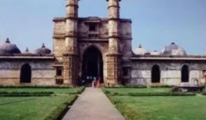
Belagavi Fort is one of the most important historical monuments in the district. The fort is associated with the Ratta rulers and the 12th century. Later rulers added and modified structures within the fort.
The fort complex reflects the cultural interaction of different periods, with temples, mosques and other architectural features located within the historic area.
British Period
Belagavi became strategically important under British rule. The city developed a significant British Cantonment, which remains an important part of its urban character.
The old city, cantonment and surrounding areas together created the distinctive urban landscape that can still be seen today.
Kittur Rani Channamma
The district is strongly associated with Kittur Rani Channamma, one of the prominent women leaders who resisted British authority in the early nineteenth century.
The Kittur region remains an important historical destination connected with her legacy and the resistance of the Kittur kingdom.
Modern Belagavi
After Indian Independence, Belagavi became part of Karnataka. The district later developed as an important centre for education, manufacturing, agriculture, sugar production, engineering and trade.
Belagavi city also gained importance as one of Karnataka’s major administrative and commercial centres.
Population of Belagavi District
According to the 2011 Census, Belagavi District had a population of 47,79,661. The district administration records a literacy rate of 75.4%.
The district has a large rural population as well as a substantial urban population centred around Belagavi and other major towns.
Belagavi’s population reflects the district’s geographical position between Karnataka, Maharashtra and Goa. Kannada has a major cultural presence, while Marathi is also widely used in several northern and border areas.
Economy of Belagavi District
Belagavi has one of the more diversified district economies in Karnataka. Agriculture and agro-processing exist alongside engineering, manufacturing and service industries.
Important economic activities include:
- Agriculture
- Sugar manufacturing
- Engineering
- Foundries
- Aerospace manufacturing
- Automobile components
- Machine tools
- Food processing
- Trade
- Transport
- Education
- Healthcare
- Construction
- Retail and services
The district administration identifies Belagavi as an important centre for foundries, heavy machine tools, high-pressure oil hydraulics and aerospace precision engineering. It also notes the presence of numerous sugar factories.
Agriculture in Belagavi
Agriculture is an important part of the district economy, especially in the rural taluks.
Major agricultural activities include cultivation of:
- Sugarcane
- Maize
- Jowar
- Wheat
- Pulses
- Groundnut
- Cotton
- Vegetables
- Fruits
Sugarcane is particularly important because it supports the district’s large sugar-processing sector.
Irrigation from rivers, dams, canals and groundwater supports farming in several areas. The different climatic zones of the district allow farmers to grow a wide range of crops.
Handloom and Traditional Industries
Belagavi has a history of cotton and silk weaving, particularly around the old city and traditional settlements.
Traditional economic activities include:
- Cotton weaving
- Silk weaving
- Handcrafted textiles
- Metalwork
- Woodwork
- Traditional food production
- Local handicrafts
The district’s cultural diversity is also visible in its traditional clothing, festivals, food and crafts.
Industries and Business in Belagavi
Belagavi is an important industrial district of Karnataka.
Engineering and Manufacturing
The district has a strong base of foundries and engineering units. These industries manufacture castings, machine components, hydraulic equipment and other industrial products.
Aerospace Industry
Belagavi has developed an important aerospace precision engineering and manufacturing cluster. Its location between Bengaluru and Mumbai also provides an advantage for industrial supply chains.
Sugar Industry
Sugar manufacturing is a major industry because of the district’s extensive sugarcane cultivation. Several sugar factories operate across different parts of the district.
Small and Medium Businesses
Other important business activities include:
- Automobile components
- Food processing
- Retail
- Transport
- Construction
- Agro-processing
- Wholesale trading
- Hospitality
- Education and healthcare services
Education in Belagavi
Belagavi is an important educational centre in northern Karnataka.
The district has schools, colleges, professional institutions and universities covering fields such as engineering, medicine, commerce, science, agriculture and humanities.
Important institutions include Visvesvaraya Technological University (VTU), which has its headquarters at Belagavi, and KLE Academy of Higher Education and Research.
The city is also known for medical and engineering education, making it an important destination for students from Karnataka and neighbouring states.
District Court in Belagavi
The District Court at Belagavi provides judicial services for the district. It deals with civil, criminal and other matters under the Indian judicial system.
Belagavi’s judicial infrastructure also serves residents from the surrounding taluks and rural areas.
For a specific case or legal service, visitors should confirm the current court location, working hours and required documents before travelling.
District Hospital and Healthcare
Belagavi has an extensive healthcare network because of its large population and importance as a regional service centre.
Healthcare facilities include:
- District-level government hospitals
- Medical colleges and teaching hospitals
- Community Health Centres
- Primary Health Centres
- Rural health facilities
- Maternal and child healthcare
- Emergency services
- Specialist medical services
- Private hospitals and clinics
Belagavi city has developed into a significant healthcare destination for northern Karnataka and nearby parts of Maharashtra and Goa.
Popular Tourist Attractions in Belagavi
Belagavi offers a combination of forts, temples, waterfalls, pilgrimage centres, historic architecture and scenic landscapes.
- Belagavi Fort
Belagavi Fort is one of the city’s most important heritage landmarks. The fort complex contains religious and architectural structures from different historical periods.
The coexistence of temples and mosques within the fort reflects the layered history of the region.
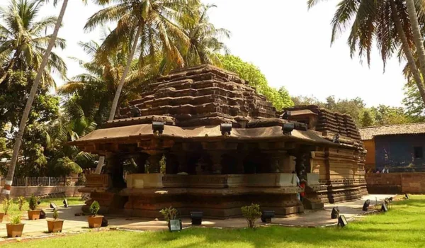
- Kamal Basti
Kamal Basti is a historic Jain temple located within the Belagavi Fort area. It is known for its late Chalukyan architectural style and the beautifully carved lotus design on the ceiling of its main hall.
- Gokak Falls
Gokak Falls is one of the best-known natural attractions of Belagavi district. The Ghataprabha River drops dramatically over a rocky gorge, creating a horseshoe-shaped waterfall.
The waterfall becomes especially impressive during the monsoon and post-monsoon season.
- Godachinmalki Falls
Godachinmalki Falls is located near Gokak and is formed by the Markandeya River. The waterfall has two distinct drops surrounded by a green valley.
It is particularly attractive during the rainy season.
- Yellamma Temple, Savadatti
The Yellamma Temple at Savadatti is one of the major pilgrimage centres of northern Karnataka. It is dedicated to Goddess Renuka, popularly worshipped as Yellamma.
Large numbers of devotees visit the temple during its major religious gatherings and fairs.
- Kittur Fort
Kittur Fort is associated with Kittur Rani Channamma, who resisted British rule in the early nineteenth century.
The fort and surrounding heritage sites are important for understanding the history of Karnataka’s resistance movements.
- Navilutirtha
Navilutirtha is a scenic valley area near Savadatti associated with the Malaprabha Dam and reservoir. It is surrounded by hills and is a popular local recreation and picnic destination.
- Rakkaskop
Rakkaskop is located near Belagavi and is associated with a dam across the Markandeya River. The surrounding hills and landscape make it a popular nearby nature destination.
- Kapileshwara Temple
Kapileshwara Temple is considered one of the old temples of Belagavi city. It is an important Shiva temple and is especially visited during Shravan and Mahashivratri.
- Suvarna Soudha
Suvarna Soudha is a prominent government building in Belagavi and is associated with Karnataka’s legislative and administrative activities. Its large architectural design makes it one of the city’s recognizable modern landmarks.
Transport and Connectivity
Road Connectivity
Belagavi has strong road connectivity with Bengaluru, Pune, Mumbai, Goa, Hubballi, Dharwad and other cities.
The district’s location between Bengaluru and Mumbai gives it considerable importance for road-based trade and transport.
Railway Connectivity
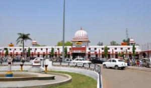
Belagavi railway station is an important railway station in northern Karnataka. Rail services connect the district with Bengaluru, Mumbai, Pune, Goa and other major destinations.
Other railway stations in the district serve towns such as Ghataprabha, Gokak Road, Chikkodi Road and Nippani-region areas.
Air Connectivity
Belagavi Airport provides air connectivity to the region. It serves as an important airport for northern Karnataka and provides access to the district headquarters and surrounding areas.
Best Time to Visit Belagavi
The most comfortable period for general sightseeing is usually October to February. The monsoon season from June to September is particularly attractive for waterfalls and green landscapes.
Visitors can consider:
- Exploring Belagavi Fort
- Visiting Kittur historical sites
- Visiting Yellamma Temple
- Exploring Gokak Falls
- Visiting Godachinmalki Falls
- Exploring Jain and Hindu heritage sites
- Enjoying the Western Ghats landscape
For waterfall tourism, the monsoon and immediately following months are generally more suitable, although visitors should check local conditions before travelling.
Nearby Cities, Districts and Areas
Important nearby cities and regions include:
- Hubballi
- Dharwad
- Bagalkot
- Gadag
- Kolhapur, Maharashtra
- Sangli, Maharashtra
- Goa
- North Goa
- Pune
- Dharwad
- Uttara Kannada
Belagavi’s location near three states—Karnataka, Maharashtra and Goa—makes it an important centre for regional trade, transportation and cultural exchange.
Why Is Belagavi District Important?
Belagavi is important because it combines historical heritage, industrial strength, agriculture, education, tourism and strategic location.
Its major strengths include:
- Major historical heritage
- Belagavi Fort
- Kittur Rani Channamma’s legacy
- Gokak and Godachinmalki waterfalls
- Important pilgrimage centres
- Strong sugar industry
- Engineering and foundry sector
- Aerospace manufacturing
- Major educational institutions
- Location near Maharashtra and Goa
The district has developed into an important economic and administrative centre while retaining its historic and cultural character.
FAQs About Belagavi District
What is Belagavi District famous for?
Belagavi is famous for its historic forts, waterfalls, temples, sugar industry, engineering sector, aerospace manufacturing and cultural diversity.
What is the headquarters of Belagavi District?
The headquarters of Belagavi District is Belagavi city.
What is the population of Belagavi District?
According to the 2011 Census, Belagavi District had a population of 47,79,661.
What is the area of Belagavi District?
Belagavi District covers approximately 13,433 sq. km.
Which are the major tourist places in Belagavi?
Major attractions include Belagavi Fort, Kamal Basti, Gokak Falls, Godachinmalki Falls, Yellamma Temple, Kittur Fort, Navilutirtha, Rakkaskop, Kapileshwara Temple and Suvarna Soudha.
Which industries are important in Belagavi?
Important industries include sugar manufacturing, foundries, engineering, aerospace, automobile components, machine tools and agro-processing.
What is the PIN code of Belagavi city?
The main PIN code of Belagavi city is 590001.
Conclusion
Belagavi District is one of Karnataka’s most important districts in terms of history, industry, agriculture, education and regional connectivity. Its location close to Maharashtra and Goa has created a distinctive cultural environment where Kannada traditions interact with neighbouring influences.
From the historic Belagavi and Kittur forts to Gokak Falls, Yellamma Temple and the Western Ghats, the district offers a wide range of attractions. At the same time, its sugar, engineering, foundry and aerospace sectors give Belagavi an important role in Karnataka’s modern economy.