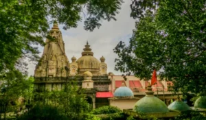
Nabarangpur District, also spelled Nabarangapur, is located in the south-western part of Odisha. The district is known for its green landscapes, tribal culture, forests, agriculture, traditional festivals and historical places. Nabarangpur town is the district headquarters.
The district has a strong tribal character, with communities such as Kandha, Paraja, Bhatra and Gond contributing to its cultural identity. Important places such as Papadahandi, Umerkote, Podagada and Kelia add historical, religious and tourism value to the district.
Quick Information About Nabarangpur District
| Particular | Details |
| District | Nabarangpur |
| State | Odisha |
| District Headquarters | Nabarangpur |
| Formation | 2 October 1992 |
| Area | 5,294 sq. km |
| Population | 12,20,946 (2011 Census) |
| Literacy Rate | About 46.4% |
| Sub-Divisions | 1 |
| Tahasils | 10 |
| Blocks | 10 |
| Main Language | Odia |
| Other Local Languages | Bhatri, Gondi and other tribal languages |
| Major Rivers/Water Systems | Indravati and local tributaries |
| Famous For | Tribal culture, forests, agriculture, historical sites and natural beauty |
| Important Towns | Nabarangpur, Umerkote, Papadahandi, Dabugam, Raighar, Jharigam and Chandahandi |
Nabarangpur covers 5,294 sq. km and has a population of more than 12.2 lakh according to the 2011 Census. The district is predominantly rural and has a high proportion of Scheduled Tribe population.
Important PIN Codes in Nabarangpur District
PIN codes are useful when sending letters, parcels, documents or identifying specific towns and post offices in Nabarangpur district. Some important PIN codes include:
| Area/Town | PIN Code |
| Nabarangpur | 764059 |
| Kosagumuda | 764061 |
| Mirganiguda | 764063 |
| Papadahandi | 764071 |
| Dabugam | 764072 |
| Umerkote | 764073 |
| Raighar | 764074 |
| Kodinga | 764075 |
| Jharigam | 764076 |
| Chandahandi | 764077 |
| Dongerbheja | 764078 |
| Khatiguda | 764085 |
PIN codes can vary between individual post offices and villages. For official postal use, the exact locality and post office should always be checked.
Important Facts About Nabarangpur District
Here are some useful facts that make Nabarangpur distinctive:
- Nabarangpur district was created from the undivided Koraput district and began functioning as a separate district in 1992.
- Nabarangpur town is the district headquarters.
- The district covers approximately 5,294 sq. km.
- According to the 2011 Census, Nabarangpur had a population of 12,20,946.
- More than half of the district’s population belonged to Scheduled Tribes in the 2011 Census.
- The district has a strong tribal and folk-cultural tradition.
- Maa Bhandargharini is an important presiding deity associated with Nabarangpur town.
- Maa Pendrani of the Umerkote region is another important local deity.
- Papadahandi has historical importance because of its connection with the freedom movement.
- Podagada is known for archaeological and historical remains.
- Agriculture is one of the main sources of livelihood.
- Forests cover a significant part of the district and support local livelihoods and biodiversity.
- Traditional dances such as Dhemsa, Rinjodi, Ghumura and Sailodi are associated with the cultural life of the region.
- Umerkote is an important commercial centre in the northern part of the district.
- The district shares a boundary with Chhattisgarh on its northern and western side.
- Nabarangpur is part of Odisha’s broader tribal and southern highland region.
Location and Geography of Nabarangpur District
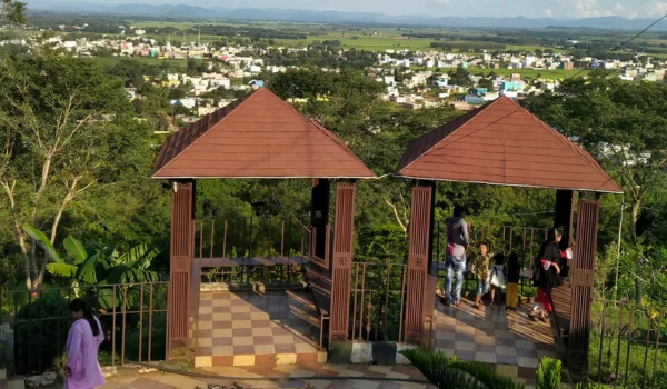
Nabarangpur is situated in south-western Odisha. Its landscape includes agricultural plains, undulating uplands, forest areas, hills and valleys. The district forms an important geographical transition zone between the Odisha highlands and neighbouring areas of Chhattisgarh.
The district shares boundaries with:
- Kalahandi District towards the east and north-east
- Koraput District towards the south
- Rayagada District towards the south-east
- Chhattisgarh towards the north and west
Important geographical features include:
- Forested and hilly landscapes
- Eastern Ghats highland areas
- Red and laterite soils
- Agricultural plains and undulating terrain
- Seasonal streams and rivers
- Areas around the Indravati river system
- Large rural and tribal settlements
- Rich natural vegetation
The geographical setting has strongly influenced agriculture, settlement patterns, tribal lifestyles and the economy of Nabarangpur.
History of Nabarangpur District
Ancient History
The region around present-day Nabarangpur has a long history connected with the ancient territories of Kalinga and southern Odisha. Different ruling dynasties exercised influence over the wider Bastar-Koraput-Nabarangpur region over many centuries.
The Nala dynasty is particularly important in the early history of the region. The ancient settlement of Pushkari, associated with the Nala rulers, was located near present-day Umerkote.
Later, the region came under the influence of several ruling houses, including the Eastern Gangas and other regional dynasties.
Medieval Period
During the medieval period, the region was connected with the political history of Chakrakota, Bastar and Jeypore. Several regional kingdoms competed for control of the area.
The territory was also influenced by the Suryavanshi rulers of Jeypore, who played an important role in the political history of the wider Koraput region.
Jeypore and Colonial Period
The area that now forms Nabarangpur district was historically administered as part of the wider Jeypore estate and Koraput region. Under British rule, Koraput became an important administrative area of southern Odisha.
Nabarangpur was initially a subdivision of the undivided Koraput district.
Freedom Movement
Nabarangpur has an important place in the history of Odisha’s freedom movement. Papadahandi became associated with a major incident during the Quit India Movement in 1942.
On 24 August 1942, protesters gathered in the Papadahandi area during the freedom struggle. Police action resulted in deaths and injuries, making the incident an important part of the local history of India’s independence movement.
Formation of the District
After Independence, administrative boundaries were gradually reorganised. Nabarangpur remained part of Koraput district for several decades before becoming a separate district.
The present Nabarangpur district began functioning on 2 October 1992, after being separated from the undivided Koraput district.
Population of Nabarangpur District
According to the 2011 Census, Nabarangpur district had a population of 12,20,946.
The population included approximately 6,04,812 males and 6,16,134 females. The district had a female-to-male ratio of around 1,019 females per 1,000 males.
Nabarangpur is predominantly rural. Around 92.8% of the population lived in rural areas according to the 2011 Census, while the urban population was around 7.2%.
Scheduled Tribes form a major part of the district’s population, accounting for approximately 55.8% in the 2011 Census. Scheduled Castes accounted for around 14.5%.
The literacy rate was approximately 46.4%, with female literacy considerably lower than male literacy at that time. Education and social development therefore remain important areas for the district.
Economy of Nabarangpur District
Nabarangpur has an economy strongly connected with agriculture, forests, livestock, rural trade and small businesses.
Major economic activities include:
- Agriculture and farming
- Horticulture
- Forest-based livelihoods
- Livestock and dairy activities
- Small-scale industries
- Local markets and retail trade
- Food processing
- Construction
- Transport services
- Government and public services
- Handicrafts and traditional activities
A large part of the rural population depends directly or indirectly on farming. The district’s tribal communities also have traditional knowledge of forest products and local agricultural practices.
Agriculture in Nabarangpur
Agriculture is one of the most important sectors of the district economy. Many households depend on farming and related activities for their livelihood.
Important crops and agricultural products include:
- Paddy
- Maize
- Pulses
- Millets
- Groundnut
- Vegetables
- Banana
- Turmeric
- Oilseeds
- Horticultural crops
The district has different soil types, including red and lateritic soils. Rainfall plays an important role in agricultural production, although irrigation development can improve farming stability.
Horticulture, vegetable cultivation and better agricultural practices are also important opportunities for improving rural incomes.
Handloom and Traditional Industries
Nabarangpur has a rich tribal and folk-cultural tradition. Traditional communities preserve various forms of music, dance, craft and local artistic expression.
Important cultural traditions include:
- Dhemsa dance
- Rinjodi folk traditions
- Ghumura
- Sailodi
- Gond and tribal cultural performances
- Bamboo and forest-based crafts
- Traditional ornaments and decorative items
Local festivals and religious celebrations also provide opportunities for traditional artists, craftsmen and small traders.
Industries and Business in Nabarangpur
Nabarangpur is not a heavily industrialised district, and its economy is primarily rural and agriculture-based. However, there are opportunities for MSMEs, food processing, horticulture-based businesses and forest-related enterprises.
Important business areas include:
- Rice and grain processing
- Food processing
- Vegetable and fruit trade
- Forest produce processing
- Small manufacturing
- Construction materials
- Retail and wholesale trade
- Transport and logistics
- Agriculture-related services
- Tourism and hospitality
The availability of agricultural resources, forest products and local markets provides a base for rural enterprises and small businesses.
Education in Nabarangpur
Education has expanded considerably across the district through government schools, higher secondary institutions, colleges and technical education centres.
Important educational centres are found in:
- Nabarangpur
- Umerkote
- Papadahandi
- Raighar
- Jharigam
- Dabugam
- Chandahandi
- Kosagumuda
- Nandahandi
- Tentulikhunti
Higher education is available through degree colleges and other institutions serving students from the district and nearby rural areas.
District Court in Nabarangpur
The district judiciary serves the legal and judicial needs of Nabarangpur district. The main judicial administration is based at Nabarangpur, the district headquarters.
The district court system deals with civil, criminal and other matters falling under the jurisdiction of the district judiciary. Additional subordinate courts and judicial institutions serve different parts of the district.
People requiring court services should check the latest local court administration for working hours, filing procedures and the jurisdiction of individual courts.
District Hospital and Healthcare
Healthcare services in Nabarangpur include government hospitals, Community Health Centres, Primary Health Centres and private medical facilities.
Important healthcare infrastructure includes:
- District Headquarters Hospital, Nabarangpur
- Community Health Centres in different blocks
- Primary Health Centres in rural areas
- Government health facilities at block level
- Private hospitals and clinics
- Maternal and child healthcare services
- Emergency and referral services
The district has a large rural population, so strengthening healthcare access in remote and tribal areas remains particularly important.
Popular Tourist Attractions in Nabarangpur District
Nabarangpur offers a combination of tribal culture, historical sites, temples, forests and natural landscapes.
- Maa Bhandargharini Temple, Nabarangpur
The Maa Bhandargharini shrine is an important religious centre in Nabarangpur. The deity is closely associated with the cultural and spiritual identity of the district headquarters.
- Papadahandi
Papadahandi is important for both history and local tourism. It is especially remembered for its connection with the 1942 freedom movement and the tragic police firing on protesters.
- Podagada
Podagada is an important historical and archaeological location in the district. The area contains remains connected with the region’s older political and cultural history.
- Kelia
Kelia is known for its religious importance, particularly the Kelia Lord Shiva Temple. The surrounding natural environment also makes it a place of interest for visitors exploring rural Nabarangpur.
- Umerkote
Umerkote is one of the major towns of Nabarangpur district. It has commercial importance as well as cultural significance, with local religious traditions associated with Maa Pendrani.
- Maa Pendrani Temple Area
The worship of Maa Pendrani in the Umerkote region is an important local religious tradition. Festivals associated with the deity attract devotees from surrounding areas.
- Chandandhara Waterfall
Chandandhara Waterfall is one of the natural attractions associated with Nabarangpur. The waterfall and surrounding greenery make it suitable for nature visits, especially during and after the monsoon season.
- Khatiguda
Khatiguda and its surrounding areas are associated with the natural landscape and water resources of the district. It can be included in a wider exploration of Nabarangpur’s countryside.
- Nabarangpur Town
Nabarangpur town combines administrative importance with temples, markets, local culture and everyday tribal-region life. It is a practical base for exploring several nearby attractions.
- Tribal Villages and Cultural Areas
The villages of Nabarangpur offer opportunities to understand the district’s traditional lifestyles, folk dances, agricultural practices and tribal culture. Visitors should respect local customs and community traditions.
Transport and Connectivity
Road Connectivity
Road transport is the main form of connectivity in Nabarangpur. Roads connect the district headquarters with Koraput, Kalahandi, Umerkote, Raighar, Papadahandi, Jharigam, Dabugam and other parts of Odisha.
National and state-level roads provide connections towards neighbouring districts and Chhattisgarh.
Railway Connectivity
Nabarangpur does not have the same level of railway connectivity as some major Odisha districts. Travellers may use railway stations in nearby districts and continue by road depending on their destination.
For long-distance journeys, Koraput and other major railway centres in southern Odisha can be important connecting points.
Air Connectivity
The district does not have a major commercial airport. Travellers generally depend on airports in other parts of Odisha, especially Jeypore or Visakhapatnam, depending on the destination and available services.
Road travel from the nearest suitable airport is generally required to reach different parts of Nabarangpur.
Best Time to Visit Nabarangpur District
The best time to explore Nabarangpur is generally during the cooler months from October to February. The weather is more comfortable for visiting temples, historical locations, villages and natural attractions.
The monsoon season can also be attractive for waterfalls and greenery, particularly around natural sites such as Chandandhara. However, heavy rainfall can make some rural and forest roads difficult.
Visitors can plan trips around:
- Historical places at Papadahandi
- Temples and religious centres
- Tribal cultural events
- Waterfalls
- Forest landscapes
- Umerkote and surrounding areas
- Rural markets and local festivals
Nearby Cities, Districts and Areas
Important nearby cities, districts and areas include:
- Koraput
- Kalahandi
- Rayagada
- Malkangiri
- Umerkote
- Papadahandi
- Jharigam
- Raighar
- Dabugam
- Chandahandi
- Chhattisgarh border areas
Nabarangpur occupies an important position in south-western Odisha because it connects tribal and rural areas with larger regional markets and neighbouring states.
Why Is Nabarangpur District Important?
Nabarangpur is important because of its combination of tribal heritage, agriculture, forests, history, religious traditions and natural landscapes.
Its major strengths include:
- Strong tribal cultural identity
- Rich folk traditions and dances
- Important historical sites
- Connection with the 1942 freedom movement
- Large agricultural base
- Significant forest resources
- Important temples and religious traditions
- Natural attractions and waterfalls
- Strategic location near Chhattisgarh
- Growing opportunities for rural businesses and tourism
The district also has importance in Odisha’s development planning because of its large rural and tribal population. Improvements in education, healthcare, irrigation, roads, agriculture and employment can have a major impact on the district’s future development.
FAQs About Nabarangpur District
What is Nabarangpur district famous for?
Nabarangpur is famous for its tribal culture, forests, agriculture, temples, folk dances, historical places and natural beauty.
When was Nabarangpur district formed?
Nabarangpur district began functioning as a separate district on 2 October 1992, after being separated from the undivided Koraput district.
What is the headquarters of Nabarangpur district?
The district headquarters is located at Nabarangpur town.
What is the population of Nabarangpur district?
According to the 2011 Census, Nabarangpur district had a population of 12,20,946.
Which are the important tourist places in Nabarangpur?
Important places include Papadahandi, Podagada, Kelia, Umerkote, Maa Bhandargharini Temple and Chandandhara Waterfall.
What is the main occupation in Nabarangpur?
Agriculture is the main occupation for a large part of the rural population. Forest-based activities, livestock, trade and small businesses are also important.
Which language is mainly spoken in Nabarangpur?
Odia is the main language, while several tribal and regional languages and dialects are also spoken by local communities.
Conclusion
Nabarangpur District is an important district of south-western Odisha with a distinctive combination of tribal heritage, history, agriculture, forests and natural beauty. From the historical importance of Papadahandi and Podagada to the religious traditions of Maa Bhandargharini and Maa Pendrani, the district has a strong cultural identity.
Its predominantly rural economy is closely connected with agriculture, forests and small businesses. With its growing road connectivity, educational and healthcare infrastructure, natural attractions and rich tribal traditions, Nabarangpur remains an important part of Odisha’s southern region and has considerable potential for sustainable tourism and rural economic development.