Chamarajanagar is a scenic district in the southern part of Karnataka, known for its forests, wildlife sanctuaries, temples, hills and rich biodiversity. Located close to the Tamil Nadu and Kerala borders, the district forms an important part of the Western Ghats and Nilgiri landscape.
The district is particularly famous for Bandipur Tiger Reserve, Biligiriranga Hills (BRT), Male Mahadeshwara Hills, Himavad Gopalaswamy Betta and B.R. Hills. Agriculture, forestry, tourism and small-scale industries are important parts of its economy.
Quick Information About Chamarajanagar District
| Particular | Details |
| District | Chamarajanagar |
| State | Karnataka |
| District Headquarters | Chamarajanagar |
| Formation | 1998 |
| Area | 5,648 sq. km |
| Population | 10,20,791 (Census 2011) |
| Literacy Rate | 61.43% |
| Taluks | 5 |
| Main Language | Kannada |
| Major Rivers | Kabini, Suvarnavathi, Chikkahole |
| Famous For | Bandipur, BRT Tiger Reserve, MM Hills, temples and forests |
| Important Towns | Chamarajanagar, Kollegal, Gundlupet, Yelandur and Hanur |
| Nearby States | Tamil Nadu and Kerala |
Chamarajanagar was carved out of the erstwhile Mysore district and became a separate district in 1998. The district administration lists an area of approximately 5,648 sq. km and a 2011 Census population of 10,20,791.
Location and Geography of Chamarajanagar
Chamarajanagar is located in the southernmost part of Karnataka. It shares boundaries with Tamil Nadu and Kerala, while neighbouring Karnataka districts include Mysuru and Mandya.
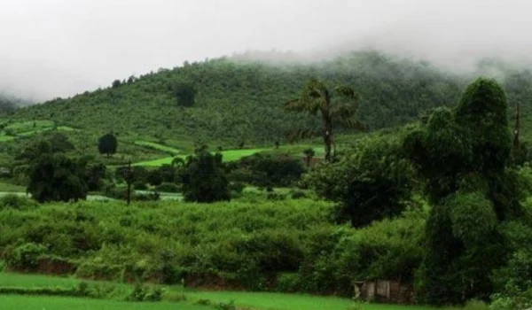
A large portion of the district is covered by forests and hills. The region forms an important ecological corridor connecting the forests of Karnataka with the Nilgiri Biosphere Reserve.
The landscape includes:
- Dense forests
- Hills and valleys
- Agricultural plains
- Wildlife habitats
- Rivers and reservoirs
- Dry and semi-arid areas
The Biligiriranga Hills and Male Mahadeshwara Hills are among the most important geographical features of the district.
History of Chamarajanagar District
Chamarajanagar has a long history connected with the Wadiyar rulers of Mysuru and several religious centres.
The district was originally part of the larger Mysore region. It was later separated from Mysore district and became an independent district in 1998.
The district headquarters was earlier known as Arikottara. It was renamed Chamarajanagar in honour of Chamaraja Wadiyar IX, the Maharaja of Mysore.
The region around Chamarajanagar, Kollegal and Male Mahadeshwara Hills has also been associated with several important temples and traditional communities for centuries.
Pincode of Chamarajanagar District
Chamarajanagar district in Karnataka has multiple PIN codes for different towns, villages and post offices. The Chamarajanagar district headquarters has PIN code 571313.
| Area / Post Office | PIN Code |
| Chamarajanagar | 571313 |
| Gundlupet | 571111 |
| Kollegala | 571440 |
| Yelandur | 571441 |
| Hanur | 571439 |
| Santhemarahalli | 571115 |
| Terakanambi | 571123 |
| Nanjangud | 571301 |
| Honganoor | 571114 |
| Yelanda | 571441 |
Population of Chamarajanagar District
According to Census 2011 data, Chamarajanagar district had a population of 10,20,791.
The district has a large rural population, with agriculture and forest-related livelihoods remaining important in many areas.
The literacy rate recorded in the 2011 Census was approximately 61.43%. The district also has a significant Scheduled Tribe population, particularly in forest and hill regions.
Economy of Chamarajanagar District
The economy of Chamarajanagar is primarily based on agriculture, horticulture, forestry, animal husbandry, tourism and small industries.
The district’s location near major forest reserves gives forestry and eco-tourism an important role, while its agricultural plains support several crops.
Major Economic Activities
- Agriculture
- Horticulture
- Sericulture
- Animal husbandry
- Forestry
- Tourism
- Food processing
- Stone and granite-related activities
- Handicrafts
- Small-scale industries
- Retail and local trade
The district’s proximity to Mysuru, Tamil Nadu and Kerala also supports regional trade.
Agriculture in Chamarajanagar
Agriculture is an important source of livelihood in the district.
Major crops and agricultural activities include:
- Ragi
- Maize
- Paddy
- Sugarcane
- Tur
- Groundnut
- Cotton
- Coconut
- Banana
- Vegetables
- Sericulture
Irrigation from rivers, reservoirs and local water resources supports farming in different parts of the district.
The district also has potential for horticulture and agro-processing because of its agricultural production.
Industries and Business in Chamarajanagar
Chamarajanagar has a relatively small industrial base compared with major Karnataka cities, but several sectors provide business opportunities.
The district has industrial areas around places such as Chamarajanagar, Gundlupet and Kollegal.
Business Opportunities
Potential sectors include:
- Food processing
- Agro-based businesses
- Silk and sericulture
- Cold storage
- Warehousing
- Tourism and homestays
- Hotels and restaurants
- Transport services
- Stone and granite-related businesses
- Retail trade
- Small manufacturing
Tourism is particularly promising because the district has several wildlife reserves, hills and religious destinations.
Education in Chamarajanagar
Chamarajanagar has schools, colleges, technical institutions and other educational facilities serving the district’s urban and rural population.
Important educational centres include:
- Government colleges in Chamarajanagar
- Government Engineering College
- Government First Grade Colleges
- Polytechnic institutions
- Industrial Training Institutes
- Schools and higher-secondary institutions
Chamarajanagar town is the main educational centre, while Kollegal, Gundlupet, Hanur and Yelandur also have educational institutions.
District Court in Chamarajanagar
Chamarajanagar has a District and Sessions Court serving the district.
The district judiciary handles civil and criminal matters and includes subordinate courts serving different taluks.
The judicial system provides access to courts for residents of Chamarajanagar and surrounding areas without requiring them to travel to Mysuru for routine district-level legal proceedings.
District Hospital and Healthcare
Chamarajanagar has a government healthcare network that includes the district hospital, taluk hospitals, community health centres and primary health centres.
The District Hospital, Chamarajanagar is the main government hospital serving the district.
Other healthcare facilities are available in places such as:
- Kollegal
- Gundlupet
- Hanur
- Yelandur
- Rural and tribal areas
The healthcare network is particularly important because a significant part of the district’s population lives in rural and forest-adjacent areas.
Popular Tourist Attractions in Chamarajanagar
Chamarajanagar is one of Karnataka’s best districts for wildlife, forests, hills, temples and nature tourism.
- Bandipur Tiger Reserve
Bandipur Tiger Reserve is one of the most famous wildlife destinations in southern India.
The reserve is part of the larger Nilgiri landscape and provides habitat for tigers, elephants, leopards, gaurs, deer and many species of birds.
It is located near Gundlupet and forms part of an important wildlife corridor connecting Karnataka with Tamil Nadu and Kerala.
- Biligiriranga Hills Tiger Reserve
The Biligiriranga Hills Tiger Reserve, commonly called BRT, is another major wildlife attraction.
The forested hills provide habitat for a wide variety of animals and are also culturally important to the Soliga tribal community.
The reserve combines wildlife conservation, forest ecosystems and indigenous cultural traditions.
- Male Mahadeshwara Hills
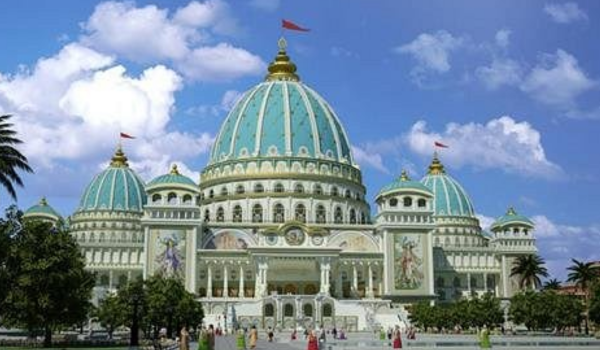
Male Mahadeshwara Hills, commonly known as MM Hills, is one of the most important pilgrimage destinations in Karnataka.
The hill is associated with Sri Male Mahadeshwara, a revered Shaiva saint. The temple attracts large numbers of devotees throughout the year.
The surrounding forests and hills also make MM Hills an important destination for nature lovers.
- Himavad Gopalaswamy Betta
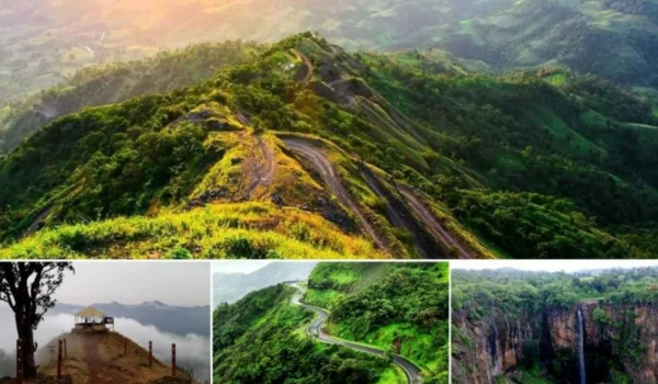
Himavad Gopalaswamy Betta is a beautiful hill destination near Gundlupet.
The hill is known for its temple dedicated to Lord Gopalaswamy and its misty landscape, particularly during the monsoon and winter months.
The surrounding forest area is part of the larger Bandipur landscape.
- B.R. Hills
B.R. Hills is known for its combination of wildlife, forests, hills and tribal culture.
The region is associated with the Soliga community and is an important ecological zone connecting the Eastern and Western Ghats.
- Biligiriranganatha Swamy Temple
The Biligiriranganatha Swamy Temple is located on the B.R. Hills and is dedicated to Lord Ranganatha.
The temple’s hilltop location provides scenic views of the surrounding forests and hills.
- Suvarnavathi Reservoir
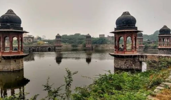
The Suvarnavathi Reservoir near Chamarajanagar is a scenic location surrounded by agricultural and semi-forested landscapes.
The reservoir is also important for irrigation in the region.
- Barachukki Falls
Barachukki Falls is located in the wider Chamarajanagar region near the Cauvery River and is one of the scenic waterfall destinations accessible from the district.
The waterfall is particularly impressive during and after the monsoon season.
Transport and Connectivity
Chamarajanagar has good road connectivity with Mysuru and neighbouring states.
Road Connectivity
Major roads connect Chamarajanagar with:
- Mysuru
- Bengaluru
- Kollegal
- Gundlupet
- Sathyamangalam
- Coimbatore
- Tamil Nadu
The road network is particularly important because several tourist attractions are located in forest and hill areas.
Railway Connectivity
Chamarajanagar Railway Station is the main railway station in the district.
Rail connectivity links the district with Mysuru and other parts of Karnataka.
Air Connectivity
The nearest major airport is Mysuru Airport, while Kempegowda International Airport, Bengaluru provides a wider range of domestic and international flights.
Best Time to Visit Chamarajanagar
The best time to explore Chamarajanagar’s wildlife and hill destinations is generally October to March.
During this period, the weather is more comfortable for sightseeing and wildlife tourism.
The monsoon months can make the forests greener and waterfalls more attractive, although some forest roads and tourist areas may be affected by heavy rainfall.
Visitors planning wildlife safaris should check the latest forest department rules, safari availability and entry restrictions before travelling.
Nearby Cities, Districts and Areas
Chamarajanagar is located close to several important cities and tourist destinations.
Nearby places include:
- Mysuru
- Nanjangud
- Gundlupet
- Kollegal
- Sathyamangalam
- Coimbatore
- Ooty
- Mandya
- Wayanad
- Erode
Its location near both Tamil Nadu and Kerala makes it an important southern gateway of Karnataka.
Why Is Chamarajanagar District Important?
Chamarajanagar is important because of its wildlife, forests, biodiversity, religious heritage and strategic location near two neighbouring states.
Its major highlights include:
- Bandipur Tiger Reserve
- BRT Tiger Reserve
- Male Mahadeshwara Hills
- Himavad Gopalaswamy Betta
- B.R. Hills
- Rich forest ecosystems
- Soliga tribal heritage
- Agriculture and sericulture
- Tourism potential
- Border connectivity with Tamil Nadu and Kerala
The district is particularly important for wildlife conservation because its forests form part of one of India’s major tiger and elephant landscapes.
FAQs About Chamarajanagar District
What is Chamarajanagar district famous for?
Chamarajanagar is famous for Bandipur Tiger Reserve, BRT Tiger Reserve, Male Mahadeshwara Hills, Himavad Gopalaswamy Betta, forests and wildlife.
When was Chamarajanagar district formed?
Chamarajanagar became a separate district of Karnataka in 1998, after being carved out of Mysore district.
What is the area of Chamarajanagar district?
The district covers approximately 5,648 square kilometres.
What is the population of Chamarajanagar district?
According to Census 2011, Chamarajanagar district had a population of approximately 10.21 lakh.
What are the popular tourist places in Chamarajanagar?
Popular attractions include Bandipur Tiger Reserve, BRT Tiger Reserve, Male Mahadeshwara Hills, Himavad Gopalaswamy Betta, B.R. Hills and Biligiriranganatha Swamy Temple.
Does Chamarajanagar have a district court and district hospital?
Yes. Chamarajanagar has a District and Sessions Court and a District Hospital, along with taluk hospitals, community health centres and primary health facilities.
Conclusion
Chamarajanagar District is a beautiful and ecologically important part of southern Karnataka. Its extensive forests, wildlife reserves, hills and religious sites give it a distinctive identity.
From the wildlife-rich Bandipur and BRT Tiger Reserves to the spiritual atmosphere of Male Mahadeshwara Hills and the scenic Himavad Gopalaswamy Betta, the district offers a combination of nature, culture and history.
Its location close to Tamil Nadu and Kerala, along with its agricultural economy and growing tourism potential, makes Chamarajanagar an important district in Karnataka